Iceland is arguably one of the most beautiful countries in the world. It is an outdoor lover’s paradise, with endless hiking opportunities and gorgeous scenic locations to visit.
Most visitors’ dream trip to Iceland is to drive Route 1 around the country, also known as Ring Road. This epic drive will take you to hundreds of stunning locations all over the country, and it truly is a must-do road trip if you have ample time!

Language: Icelandic & English
Currency: Icelandic Króna (ISK).
Major Airport:
Keflavík International Airport (KEF)
Best Time To Visit:
Full Country: June to August
Northern Lights: September to March
★ Must Visit Locations ★
How many days do you need for a Ring Road trip?
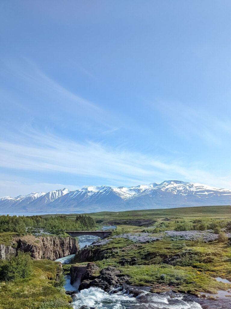
Þjóðvegur 1 (Route 1), aka Ring Road, is 821.5 miles (1322 km), and makes a circle around the entire country of Iceland, hence the nickname. However, this distance does not include any additions or detours you may make during your trip, and chances are you will be adding additional driving; there are just too many great things to see just off of the main road.
The bare minimum suggested time to drive around Ring Road is 7 days. However, I would suggest no less than 9 days; ideally, you should add more. There are so many great things to see, and you would really be rushing yourself with anything less than 9 days, potentially missing out on some must-visit locations. Shoot for 10 to 12 days to give yourself ample time to see as much as you can without feeling rushed.
In 2023, I made the drive around the Ring Road with a few additions, and as such, I have put together this itinerary for a 10-day trip around the Ring Road (and beyond!). This itinerary is a combination of my own trip and changes I’d make based on what I learned during that trip.
IMPORTANT: This is a summer itinerary. Many areas and roads are closed during the winter, which may make this itinerary impossible outside of the summer months.
What can you expect on a summer Iceland road trip?
Expect to spend a lot of time driving. You will likely drive 3 to 4 hours per day, with many stops along the way, sometimes only a few minutes apart. There is a lot of sightseeing to do; that’s what this trip is about, after all. You are here to see the many beautiful sights Iceland offers across the country. You won’t be able to see everything on one trip, but with some good planning, you can jam-pack your days to get the most out of your trip!
Don’t Forget to Check Out My Tips for Traveling Iceland
Helpful Tips for Traveling Iceland
Planning your Iceland road trip
May to September is the optimal time to visit Iceland if you want to drive the full Ring Road itinerary. However, it is still possible that the shoulder months could have some closures. August is the busiest time to visit Iceland. We visited in June; there were no closures, the weather was great, and it was a little bit less busy as the full summer tourist season hadn’t picked up yet.
The most important thing about planning this trip is that you book well in advance. Iceland is a small country, and while it is great at catering to tourists, there are only so many accommodations along the Ring Road, especially in more remote locations. If you do not book early enough, you risk having nowhere to stay or paying exorbitant prices. The same goes for rental cars. If you are particular about a specific type of car or camper, book early!
Driving in Iceland
Route 1 and other main roads around Iceland are paved and well-maintained. They are often two lanes with the occasional one-lane bridge or tunnel. However, leaving these main roads makes you more likely to run into unpaved narrow roads. While you won’t see too many of them on a Ring Road trip, there may still be some instances where a certain location you want to visit is up a bumpy, narrow dirt road.
Stay alert and cautious while driving. There are speed cameras throughout the country and the aforementioned one-lane bridges and tunnels. Proceed with caution in these situations and pull off to the side or wait for oncoming traffic if necessary.
Don’t Forget to Download These Apps for Your Iceland Trip –
Must Have Apps for Your Iceland Road Trip
Renting a Car
If you are truly sticking to the main Ring Road and going nowhere near the highlands, you can rent a simple 2WD vehicle, especially in the summer; there will really won’t be situations where you require a 4WD (4×4) vehicle.
If you expect to spend some time in the highlands (the center of the country), you will need a 4WD vehicle, as these roads can be rough and include river crossings. However, none of that will be covered in this itinerary.
We rented a 4WD Hyundai Tucson for our trip. Having a 4WD vehicle made us feel more comfortable in situations where we were driving up long unpaved roads, and while we didn’t do it often, we were grateful for the vehicle we had the times that we did.
There are a few stops along the Ring Road where you can choose between two different viewpoints; often, one is down a paved road while the other is unpaved. If you expect to visit the unpaved sections more often, consider a 4WD vehicle.
IMPORTANT: Make sure you reserve an automatic car if you can’t drive a manual car
We rented our vehicle from Lava Car Rental. Overall, we had a decent experience. It wasn’t perfect—the check engine light was on the entire 10 days, and we called to ask about it. The airport pickup was also a huge mess; the directions were not clear, and the pickup van was far too small for the number of people waiting. But other than those two things, it was a good experience. Booking the car online was super straightforward, and pick-up/drop-off was easy.
Detailed Itinerary
Below is my 10-day itinerary broken out by day and general location. You can adjust it as necessary for your own trip. For instance, on my 2023 trip, we only spent a single day on the South Coast, but I wish we had spent more time there. You could also skip visiting the peninsulas if you are short on time!
This particular itinerary goes counterclockwise around Ring Road. You can flip the itinerary to go clockwise if you prefer to spend the early part of the trip in the less touristy locations and finish in the more touristy locations.
Also, expect to start your day early every day. You want to see as much as you can, and while Iceland is light for nearly 24 hours in the summer, that doesn’t mean everything is open 24 hours. Not everything is right off the side of the road, and there will be times when you have to make a small detour or hike to see something, which takes up additional time.
Without further ado, here is my 10-day summer itinerary for Iceland!
Day 1: Arrival, Blue Lagoon, & Reykjavik
Driving Time: Approximately 1.1 hours | Ending Location: Reykjavik
Welcome to Iceland! You’ve just landed at Keflavik International Airport, which is located on the southern peninsula (Reykjanes Peninsula) and about an hour from Reykjavik. If you are arriving from North America, it’s likely early in the morning.
After you’ve passed through immigration and picked up your checked luggage, follow the directions to your rental car. You will either head straight to the rental car pick-up location or to a passenger pickup area to drive to your rental car.
After picking up your car and familiarizing yourself with it, you have a couple of options for starting your Iceland adventure. You can either head to a hot spring or go straight to Reykjavik.
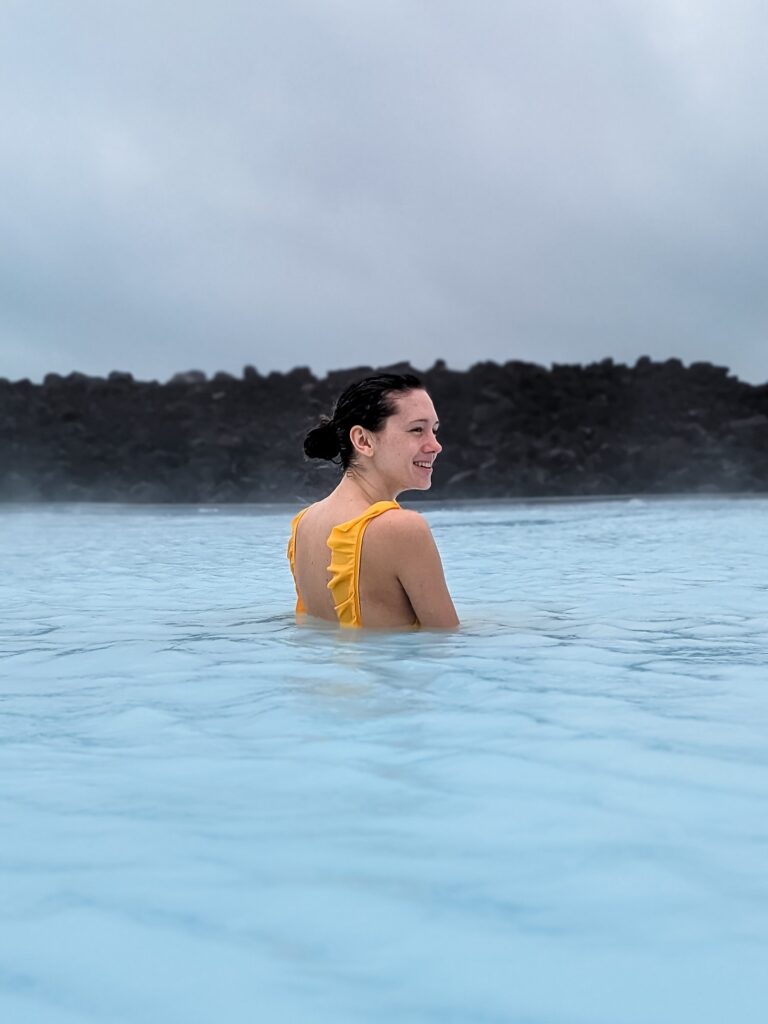
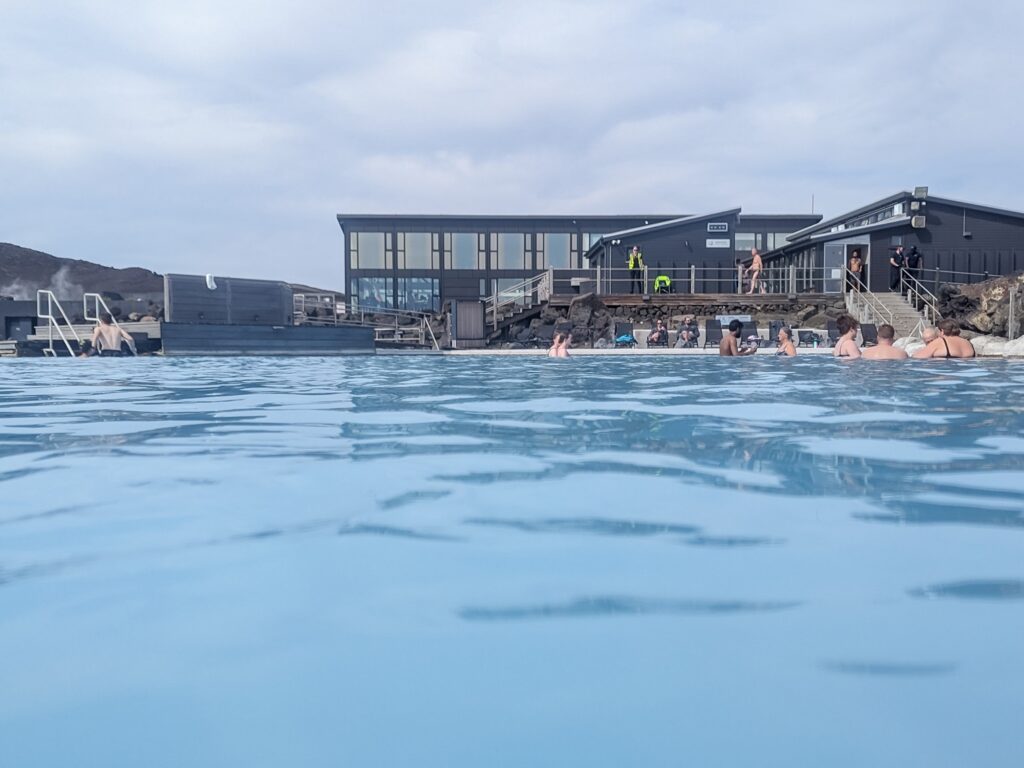
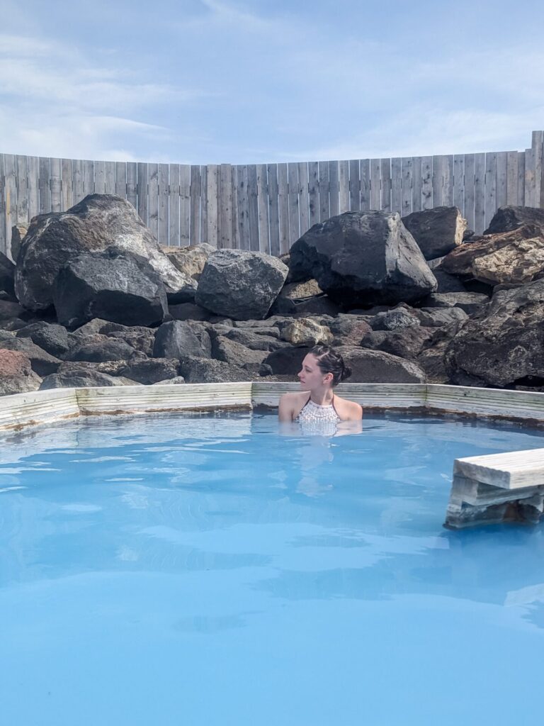
My suggestion is to head to the 📍Blue Lagoon. Make sure you’ve made a timed reservation ahead of time, as it can sell out during the summer months. Schedule the reservation for about 2-3 hours after you land so that you have plenty of time to collect your bags and rental car.
You can spend a few hours at the Blue Lagoon relaxing and enjoying the blue geothermal pools, mud masks, and saunas. It’s the perfect way to start your trip after a long flight and immediately check off one of the top tourist locations.
If you aren’t interested in the Blue Lagoon, consider the Sky Lagoon in Reykjavik.
IMPORTANT: There have been ongoing volcanic eruptions near the Blue Lagoon and Grindavik in 2024. This area may not be open due to these eruptions; double-check before your trip to ensure that the Blue Lagoon is open. If it’s not open, consider heading to the Sky Lagoon near Reykjavik.
If you are staying at one of the Blue Lagoon hotels, you may be evacuated due to eruptions.
After spending your fill of time soaking at the Blue Lagoon, make the 45-minute drive into Reykjavik. At this point, you should be able to check into your hotel and drop your bags off. Now, you can explore downtown Reykjavik!
📍Reykjavik is pretty small by city standards and easily walkable. With the remaining half day, you should be able to see everything of interest. Don’t worry if you miss something; we will be back at the end of the trip for a short period.
Things to do in Reykjavik:
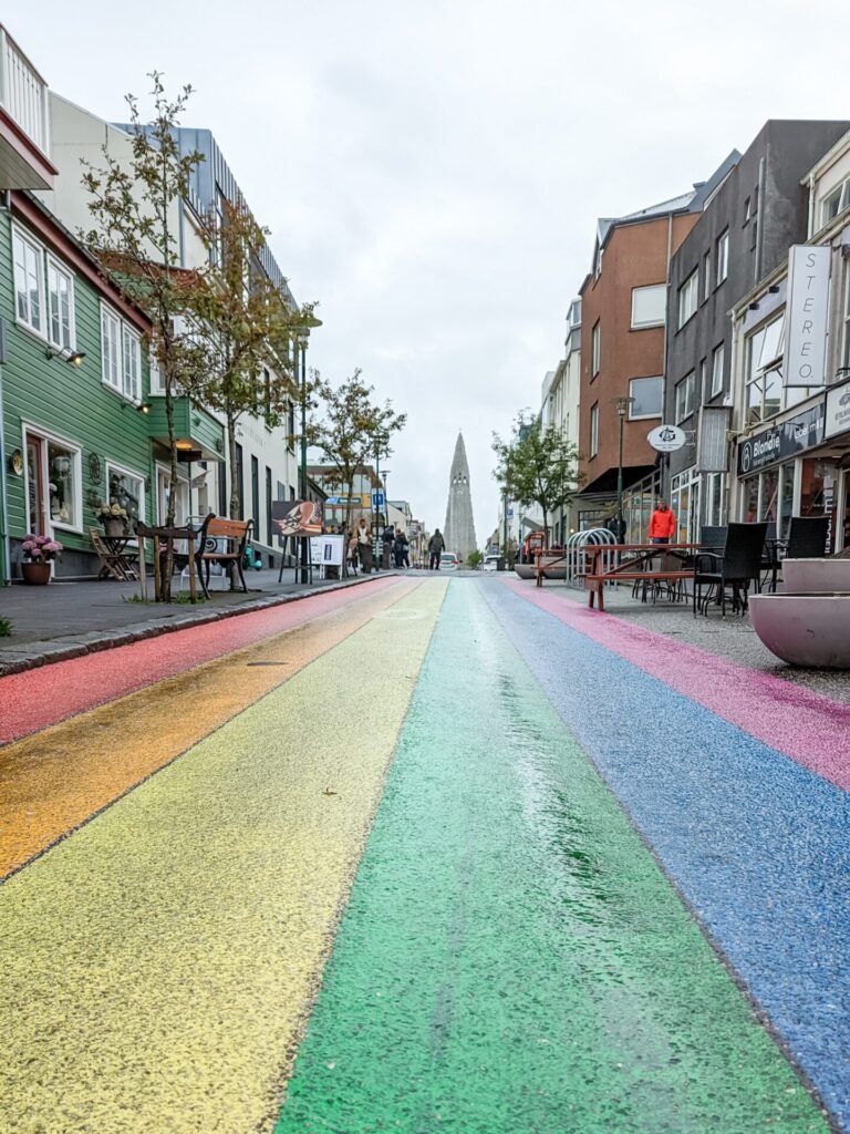
- Walk down Rainbow Street (Skólavörðustígur)
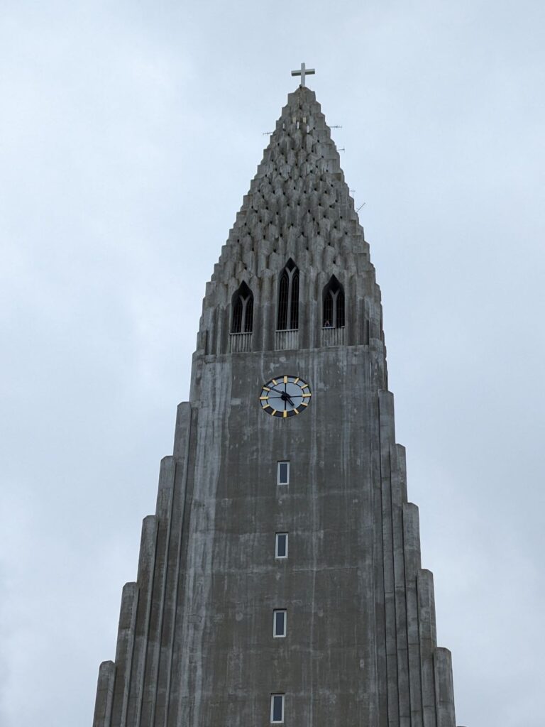
- Visit Hallgrimskirkja, Iceland’s largest church (there is a viewing deck at the top)
- Walk around and take photos at Tjörnin Lake
- Check out the architecture at the Harpa Concert Hall
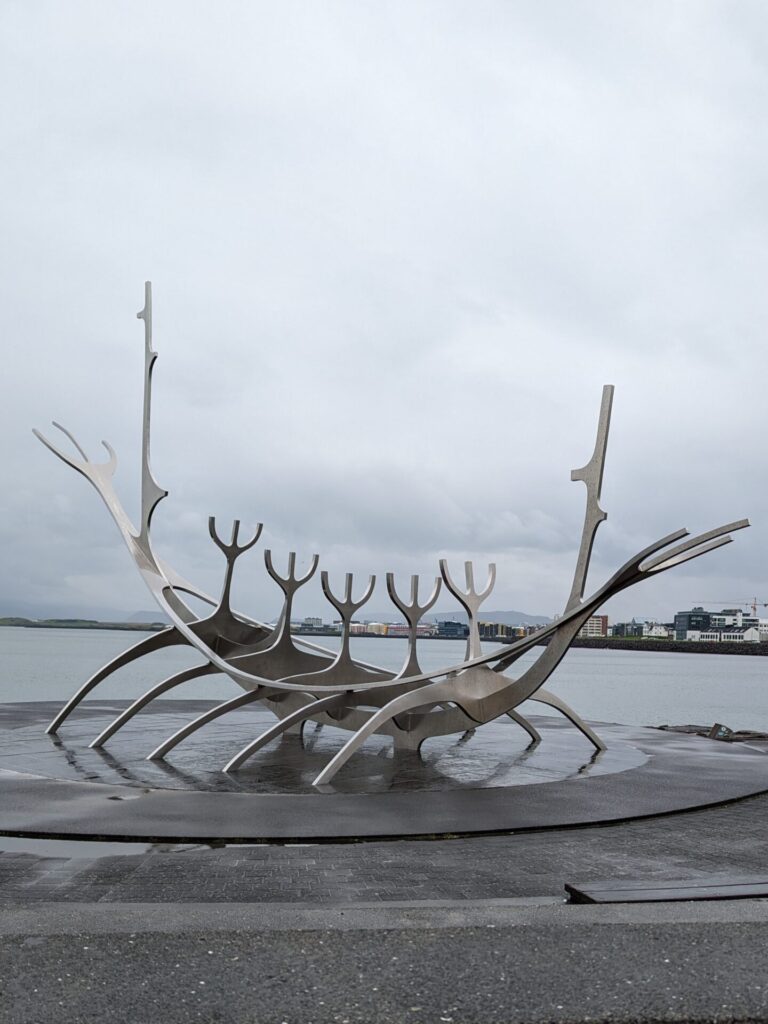
- Enjoy the view at the Sun Voyager Sculpture
- Look for all of the colorful street art
- Pick up some pastries at Sandhold
- Enjoy a famous Bæjarins Beztu Pylsur hot dog
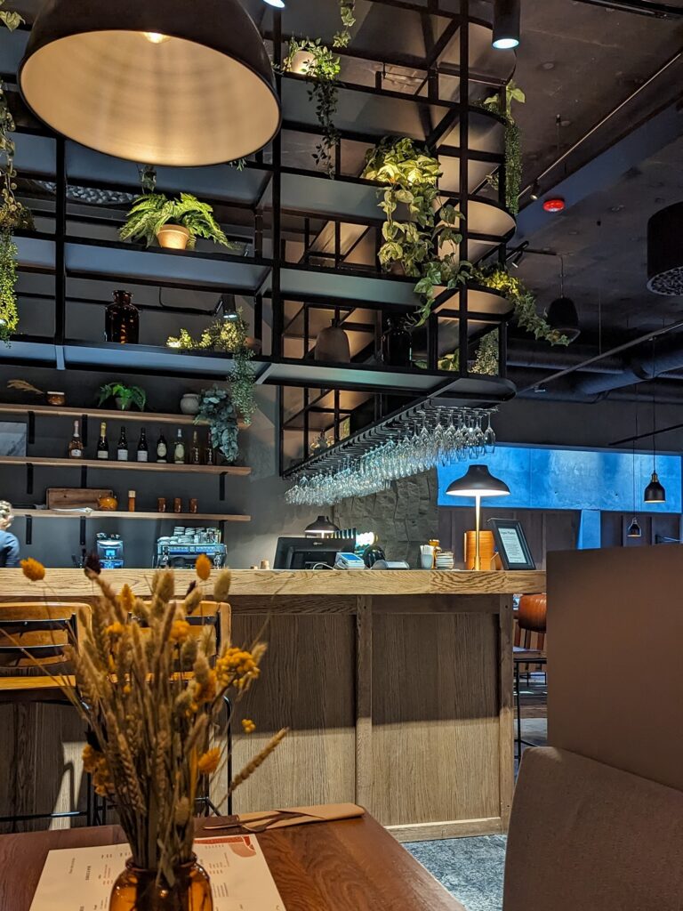
Where to Stay in Reykjavik
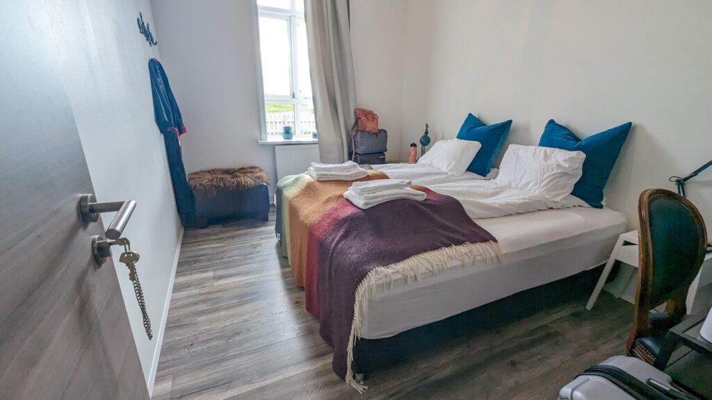
Try to stay in central Reykjavik near Rainbow Street; it’s the most optimal location to see everything within walking distance and is also a good location for food. We stayed at A Room With A View and parked our car nearby at Traðarkot – Parking House.
Parking in Iceland is super easy. You can either pay via an app or at a kiosk that requires you to enter your license plate or choose your license plate from a photo.
Day 2: Golden Circle (Reykjavik → Hella)
Driving Time: Approximately 3.5 hours | Ending Location: Selfoss or Hella
We are going to start our Ring Road trip by leaving the Ring Road and heading towards the Golden Circle. The Golden Circle is an area to the east of Reykjavik full of great sightseeing spots and is one of the country’s most heavily tourist areas.
You can make your way north out of Reykjavik via Route 1, but when you reach Route 36, turn east and head into the Golden Circle.
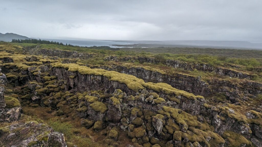
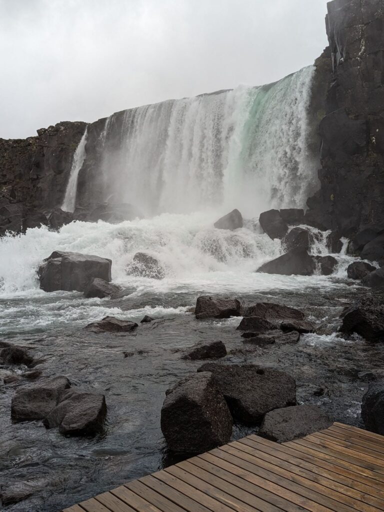
Today’s first stop will be at 📍Þingvellir (Thingvellir) National Park. This location is a UNESCO World Heritage Site. Here, you can see the landscape created by Icelands two tectonic plates splitting apart. You will walk winding paths to see waterfalls, a quaint church, and a lake in the park. If you are feeling adventurous, you can snorkel between the tectonic plates at the Silfra Fissure! There is a 1,000 ISK parking fee, which goes towards maintaining the park.
Make sure you stop at the Hrafnagjá Observation Deck, where you will get a great view of the tectonic fissures and lake.
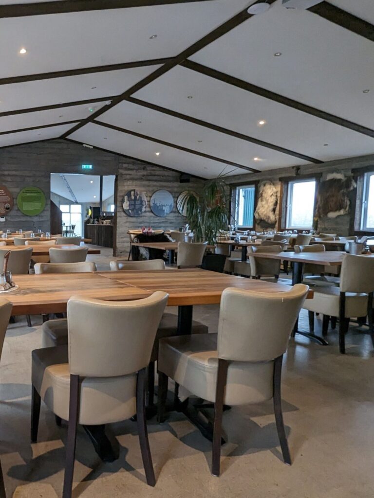
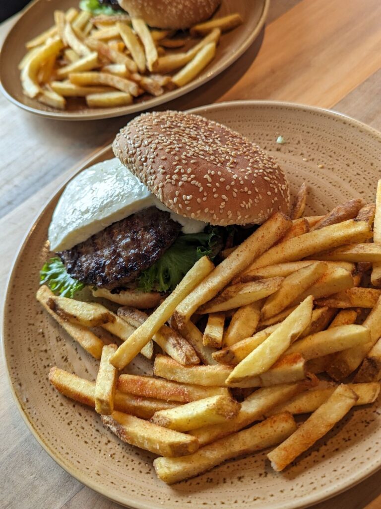
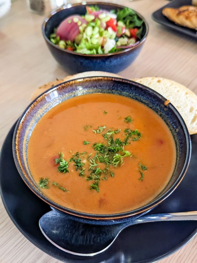
If you spent a while at Thingvellir and it is late enough in the day that you are starting to feel hungry, I suggest stopping at 📍Efstidalur II for lunch. It’s a hotel with a farm-to-table restaurant. They have an ice cream parlor and serve burgers and steak in their restaurant. It was really delicious and a food highlight of our trip.
A little way east of the restaurant, there is a trailhead you can park at and then hike to multiple waterfalls. The hike is along the Brúará Trail and is approximately 4.4 miles (7km) out and back. The hike’s highlight is 📍Brúarfoss, often called Iceland’s Bluest Waterfall. If you don’t want to hike to see Brúarfoss, there is a new parking lot that is significantly closer and requires a much shorter walk; however, there is a 750 ISK parking fee.
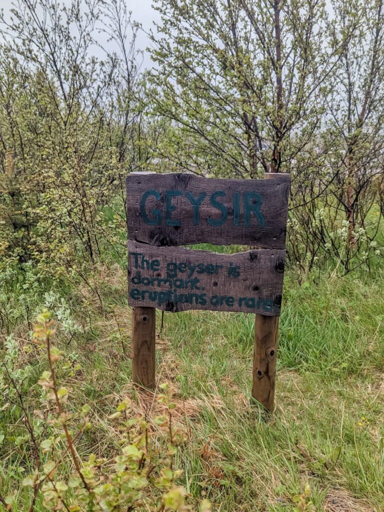
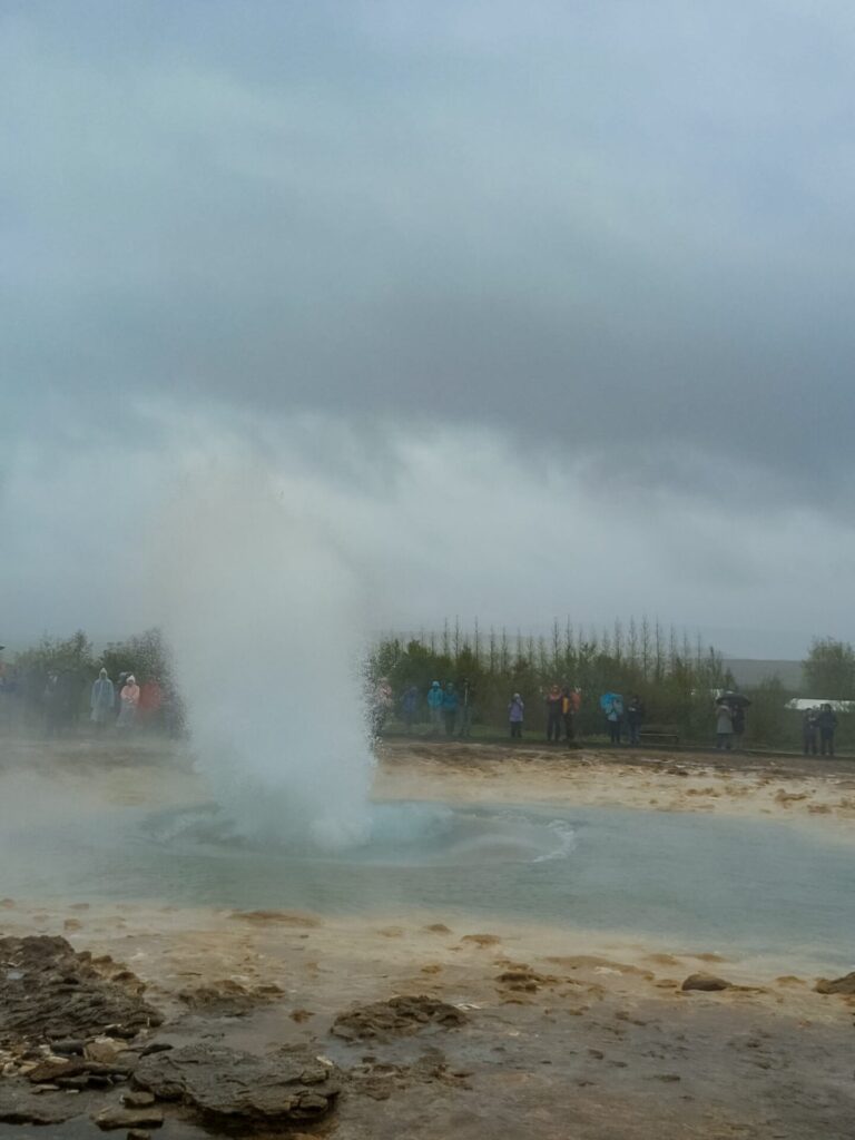
If you skip visiting Brúarfoss, continue to Route 35 and stop at 📍Geysir and Strokkur. Geysir is the namesake for the English word Geyser. Geysir is dormant and rarely erupts. Luckily, Strokkur, right next to it, is active and goes off every 5 to 10 minutes. Expect crowds at this stop!
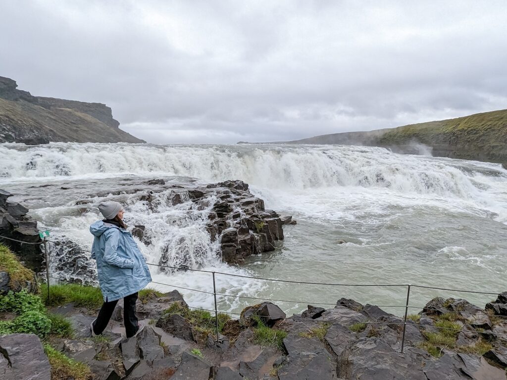
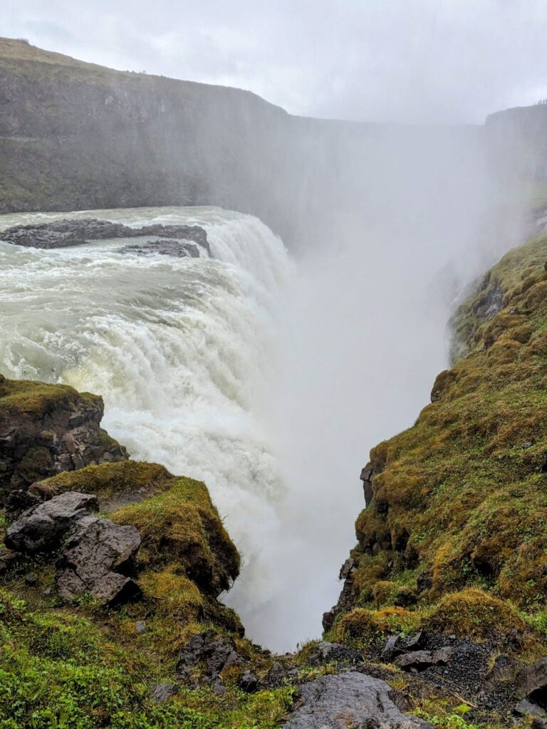
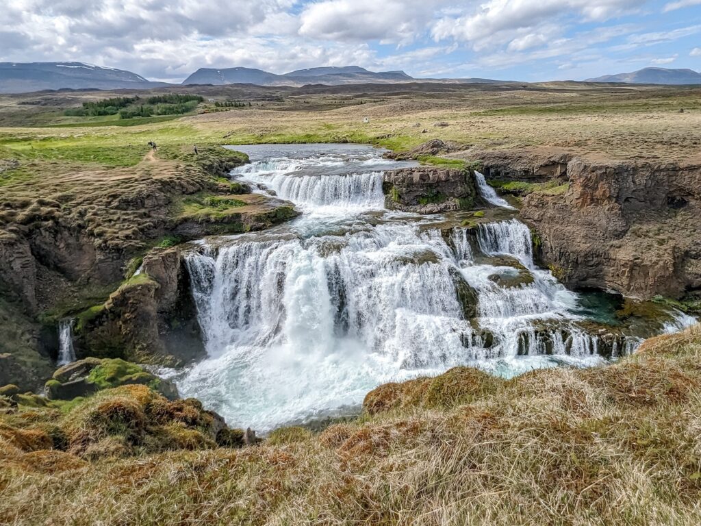
From Geysir, continue east to 📍Gullfoss, one of Iceland’s most well-known and iconic waterfalls. This is a huge, powerful two-level waterfall with multiple viewpoints. The parking area is huge, and there is a visitor center with a cafe and restrooms. You can spend quite a while visiting this waterfall if you visit all of the viewpoints. I highly recommend heading down to the lower viewing area, where you can get close to the upper section of the falls.
After leaving Gullfoss, you can head south on Route 30 or Route 35. Take Route 30 if you’d like to visit a geothermal pool. There are two options: the 📍Secret Lagoon or Hrunalaug Hot Spring, which is owned by a local farmer.
I personally would suggest taking Route 35 towards Kerid Crater, as you will have many more chances to visit other geothermal pools throughout your Ring Road trip.
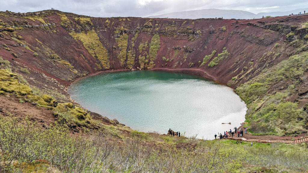
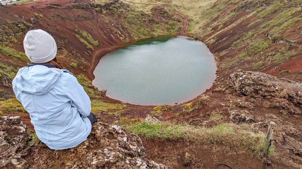
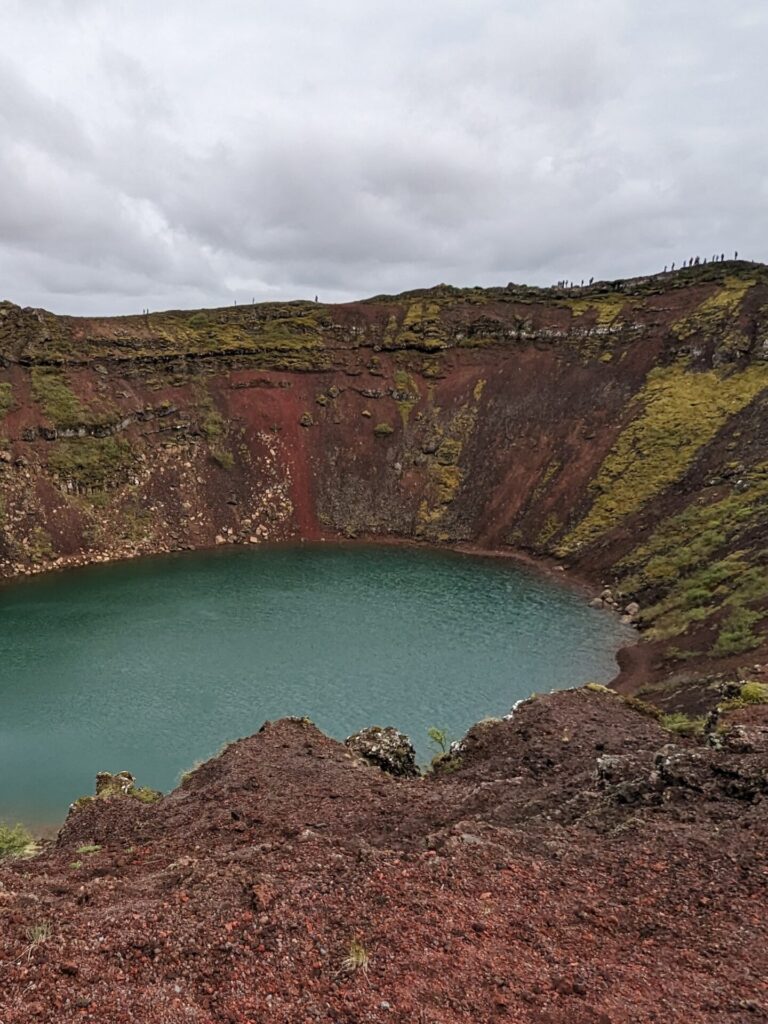
Your next stop is at 📍Kerid Crater, a turquoise lake in a volcanic crater. There is a 400 ISK fee to visit the crater, which allows you to walk the perimeter of the crater and hike down to the lake. Some people suggest skipping this stop, especially because parking can be a nightmare. However, I found it to be very enjoyable and would recommend stopping here if possible.
At this point in your day, it’s likely mid-to-late afternoon. If you still have an abundance of energy and aren’t hungry, you can take a small detour to the west and hike 4.9 miles (7.9km) to 📍Reykjadalur Hot Spring, a natural thermal river.
Instead, I suggest heading east into Selfoss or Hella to fill up your car and get some dinner! You are going to have two long days ahead, so don’t over-exert yourself too early in the trip. We stopped for dinner at 📍Erbil Kebab.
Things to do in the Golden Circle:
- Visit Þingvellir (Thingvellir) National Park
- Go snorkeling in Silfra Fissure
- Visit Laugarvatn Fontana to try bread baked in the ground
- Eat lunch and have ice cream at Efstidalur II
- Hike the Brúará Trail to Brúarfoss
- Visit Geysir and Strokkur and watch Strokkur erupt
- Check out multiple viewpoints at Gullfoss
- Soak in a geothermal bath at Secret Lagoon or Hrunalaug Hot Spring
- Hike around Kerid Crater
- Hike to the Reykjadalur Hot Spring Thermal River
Where to Stay After Driving the Golden Circle
My suggestion is to end your day and stay in Hella because it positions you closer to the first stop for the following day. We stayed the night at Hotel Kansarlinn. If you can’t find accommodation in Hella, you can also stay in Selfoss or any guesthouse in the general area.
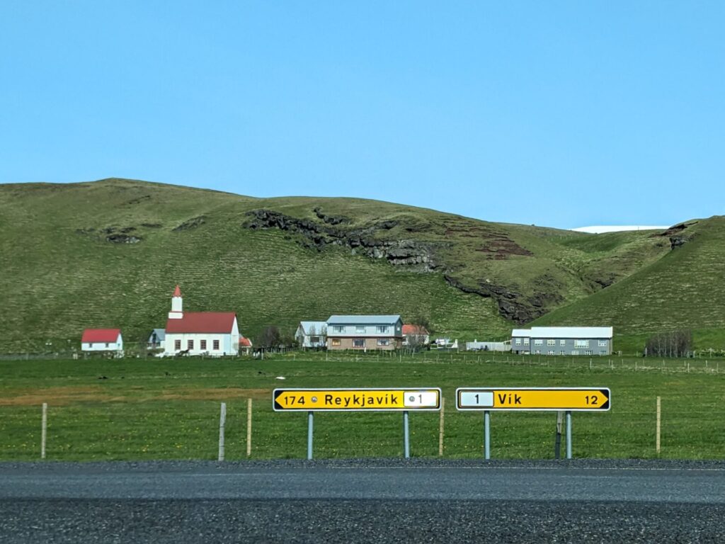
Day 3: South Cost (Hella → Vik)
Driving Time: Approximately 1.25 hours | Ending Location: Vik
I hope you are ready for two jam-packed days because there is so much to do on Iceland’s south coast. We only spent a single day on the south coast, and it’s my biggest regret; I could have spent so much more time here exploring. Which is why I’m suggesting two days so you don’t make my mistake!
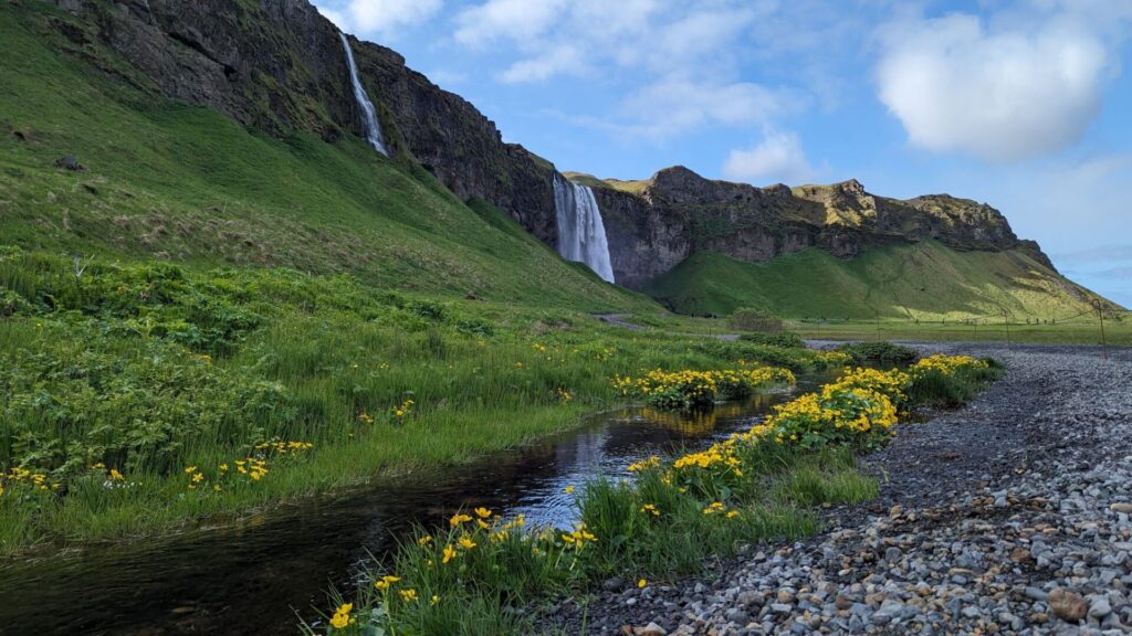
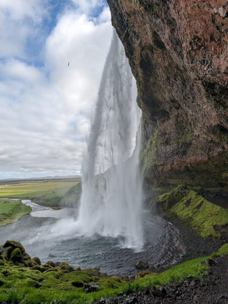
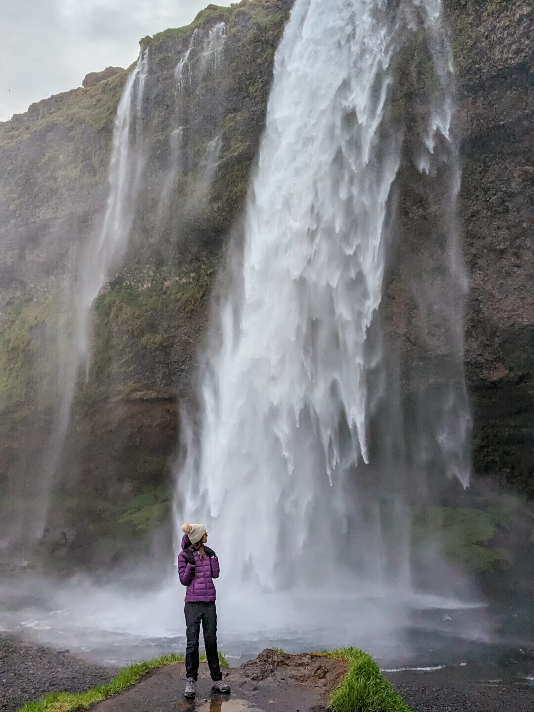
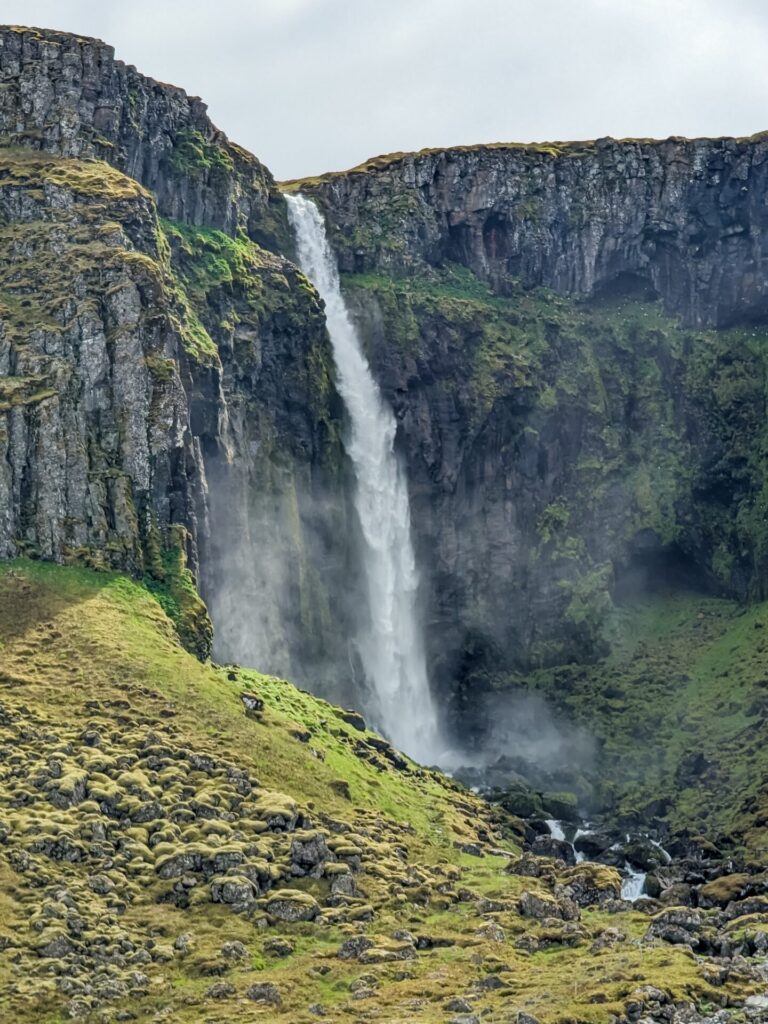
Your first stop of the day is going to be at 📍Seljalandsfoss and Gljufrabui. Parking for these two waterfalls is just north of Route 1. Seljalandsfoss is a 200-foot waterfall surrounded by mossy cliffs. Make sure you are wearing your rain gear because you are going to get wet walking behind this waterfall!
Follow the path north of Seljalandsfoss to visit Gljufrabui. The waterfall is hidden in a canyon and is a 10-minute walk away. If you intend to climb inside, you will need full waterproof gear.
Our next stop is 📍Skógafoss, another very popular and famous waterfall. You can get very close to this one and even get a bird’s-eye view! If you want to see more waterfalls, climb the stairs to the right of Skógafoss and continue down Waterfall Way to see a few more falls along the Skógá River. The trail is about 5 miles (8km) total, so hike as much or as little as you want!

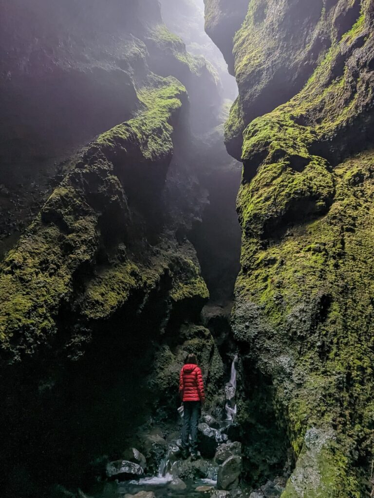
Head immediately east to 📍Kvernufoss. A significantly quieter, if not more beautiful, waterfall. This one tends to be a hidden gem in plain sight. You will have to make a short 15-minute walk to get to the falls, but it is completely worth it. The waterfall is set back in a mossy gorge.
In the same parking lot as Kvernufoss, you will find the 📍Skógar Museum. The museum explores Iceland’s history and has a model turf-house village. If you have time, consider a visit.
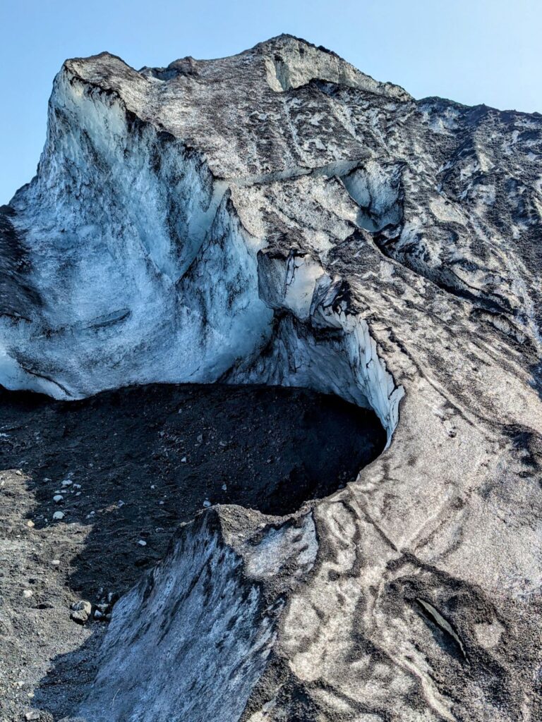
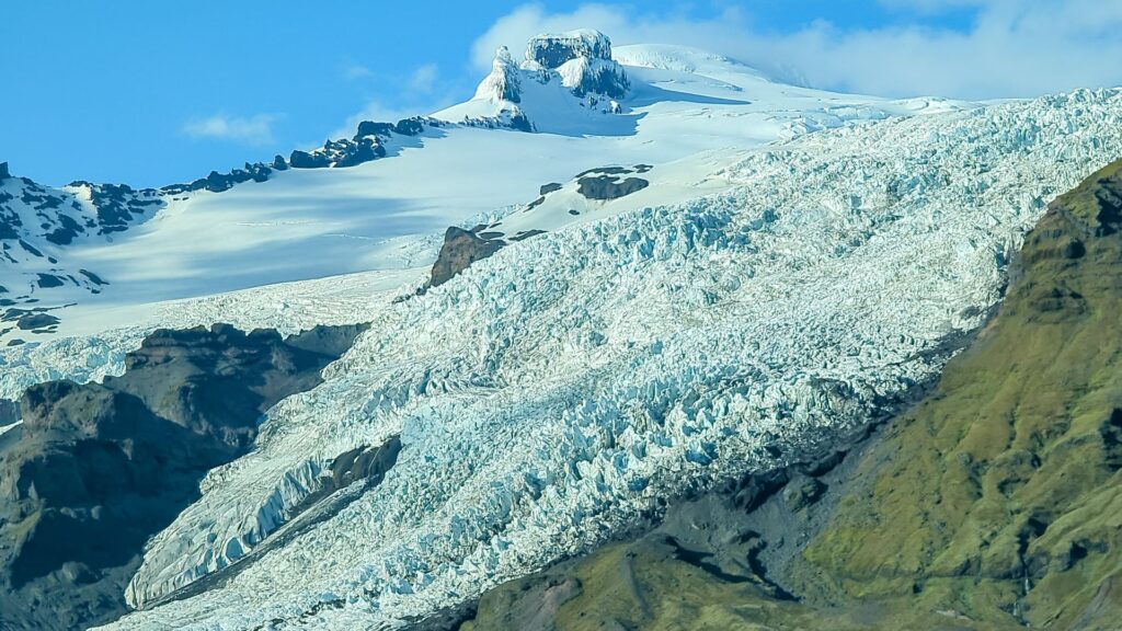
Now is your chance to visit your first glacier, 📍Sólheimajökull. If you are interested, you can book a tour to hike on this glacier. Check out Arctic Adventures or Troll Expeditions for different tours. If you don’t want to take a tour to hike on the glacier, you can still visit. It’s a short 15-20-minute hike to the glacier, and you can walk right up the glacier if there are good conditions.
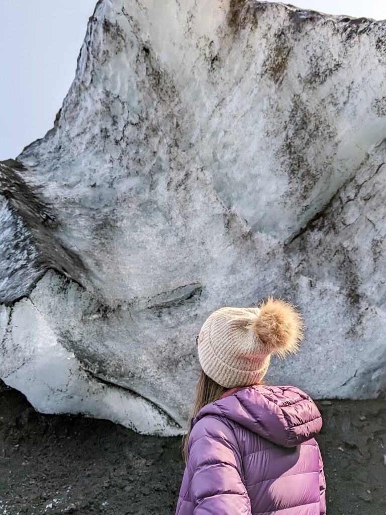
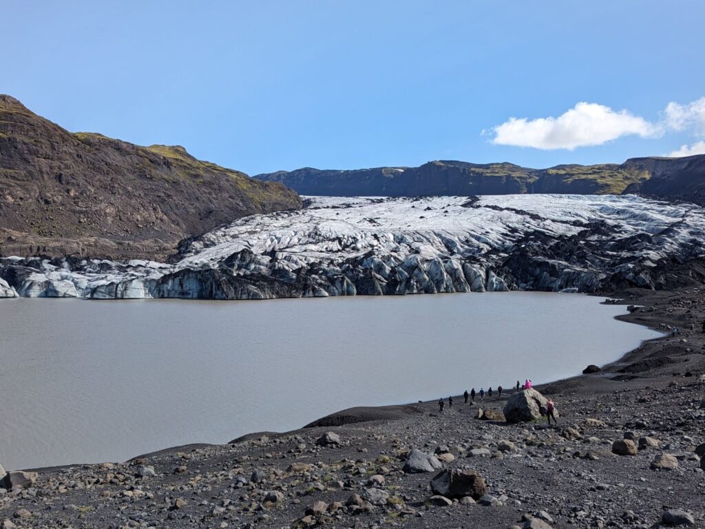
If you visit this glacier or any glacier, be respectful. Don’t be like the tourists we saw, using rocks to bash chunks of ice off the glacier to hold them. It’s dangerous and disrespectful.
Just beyond the turn-off for Sólheimajökull is the parking lot for the 📍Sólheimasandur Plane Wreck. Hiking to the plane takes approximately 1 hour and 30 minutes round trip. A shuttle bus is also available for 3,000 ISK. We skipped this stop due to time constraints, but a lot of people really enjoy this stop!
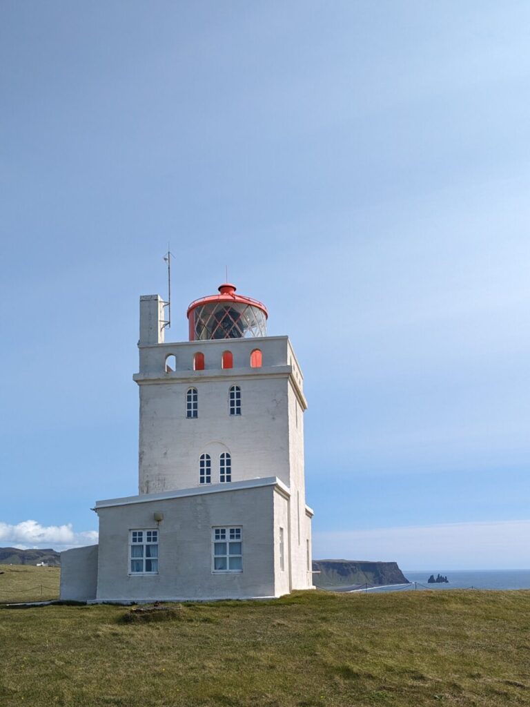
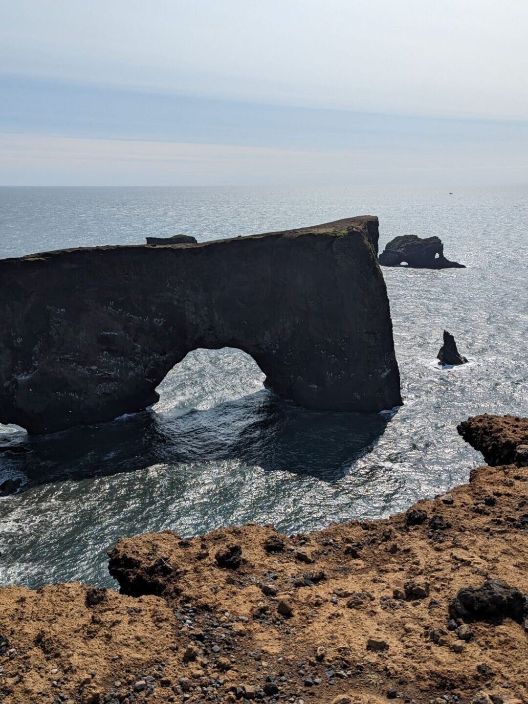
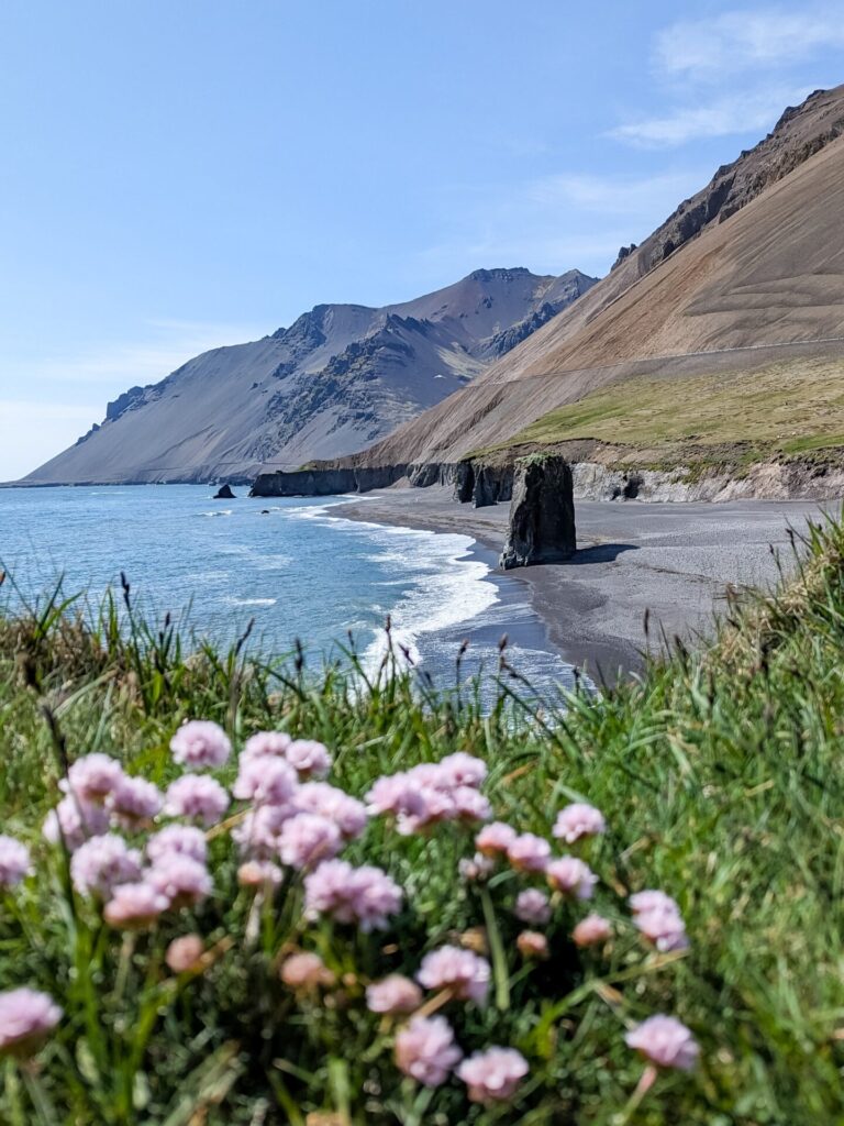
Your next stop is 📍Dyrhólaey. Head to the top of the cliff and park near the lighthouse. Be wary; this area can be very windy, so mind your car doors. The lookout has a view of the endless black sand beaches and the arch out in the water. You can also walk along the many paths to get closer to the beach and ocean views. If you are lucky, you may even see puffins perched on the rocks.
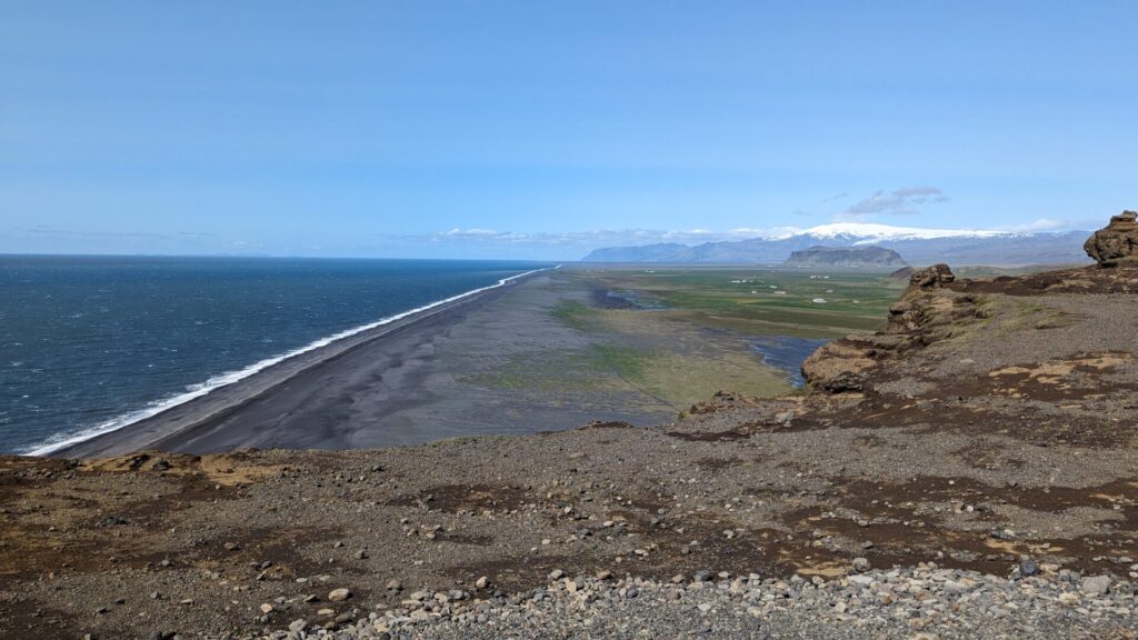
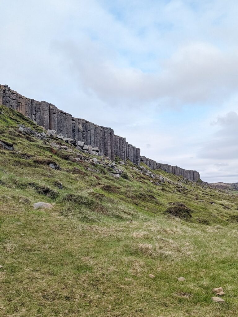
Next, you should head to 📍Reynisfjara Beach. This is probably the most famous beach in Iceland but also the most dangerous. The beach is gorgeous and dramatic, with black sand, basalt columns, and a cave. However, the waves here can be dangerous, so follow any warning signs and do not get near the water. To put it bluntly, people die here. Be safe!
IMPORTANT: As of February 2026, Retynisfjara Beach has had significant erosion due to winter waves and has mostly vanished.
After the beach, make your way into Vik. It’s time for lunch. I recommend 📍Black Crust Pizzeria.

Spend the remainder of your first day visiting the hour-long 📍Vik Lava Show (5,900 ISK) and go on a tour from Vik, such as the Katla Ice Cave Tour.
If you aren’t interested in a tour from Vik, you can continue down Route 1 and see a few more things before finishing your day. I will cover these stops on Day 4!
Things to do along the South Coast (Hella → Vik):
- Walk behind Seljalandsfoss
- Climb into a gorge and see Gljufrabui
- Hike on a glacier at Sólheimajökull
- Walk to the beach and see a wrecked DC-3 Plane
- See the arch at the Dyrhólaey Viewpoint
- Walk through black sand at Reynisfjara Beach
- Visit the Lava Show in Vik and see real lava
- Have some delicious pizza at Black Crust Pizzeria in Vik
Where to Stay on the South Coast
For your first night on the South Coast, I would stay in (or around) Vik. It is one of the bigger towns, with multiple hotels and food choices. If you don’t want to go on a tour and you continue past Vik, there are some guesthouses along the drive, which I’ve noted above!
Day 4: South Cost (Vik → Höfn)
Driving Time: Approximately 3.25 hours | Ending Location: Höfn
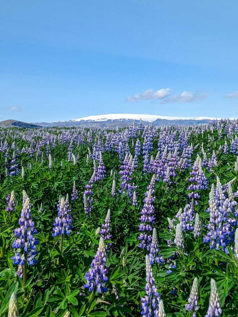
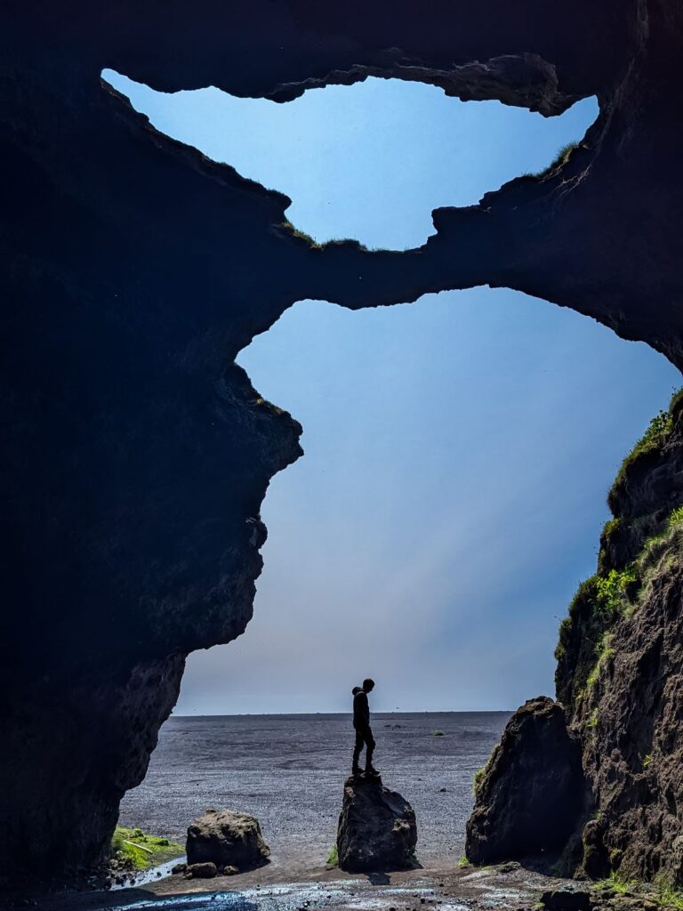
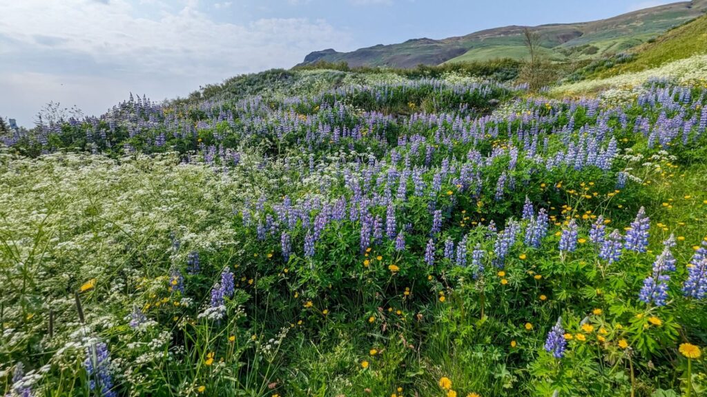
Leaving from Vik, your first stop of the day should be 📍Gígjagjá, aka the Yoda Cave. You can drive right up to the entrance of this cave, which makes it really easy to visit. Do note that the road from Route 1 to the cave is a dirt road that is pretty bumpy, so it will be a slow drive. This is also a great area to get up close with the lupine flowers in the summer!
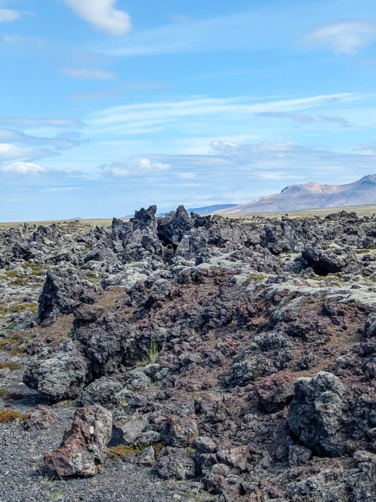
After the cave, continue east on Ring Road. You will drive through a really neat-looking lava flow area. The lava is covered in moss, giving it almost a Dr. Seuss-type vibe. Lumpy, mossy lava rocks! If you’d like to stop, there are some areas to pull off, but you can also just view this area from the car.
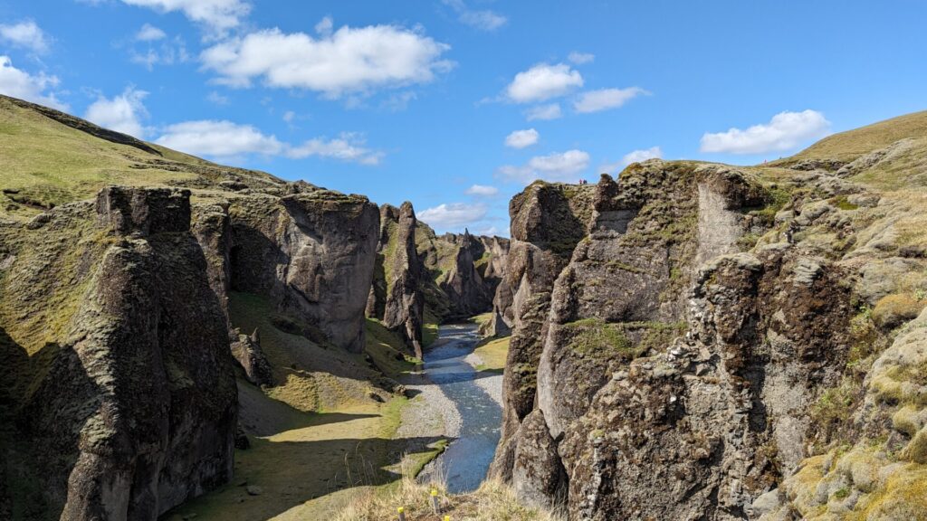
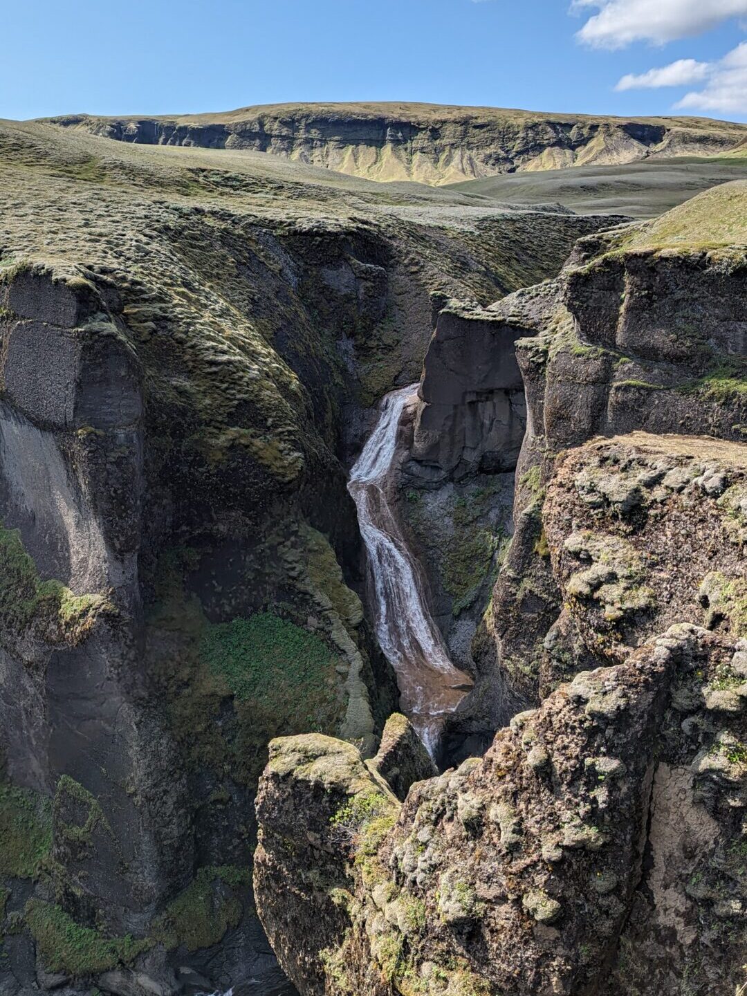
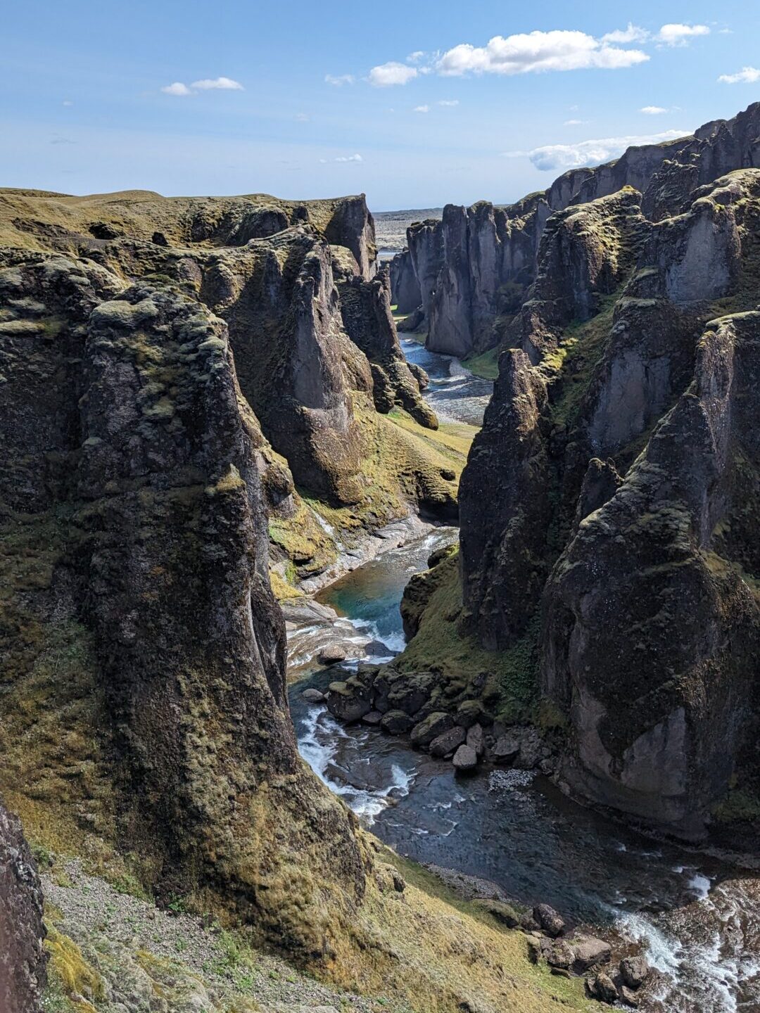
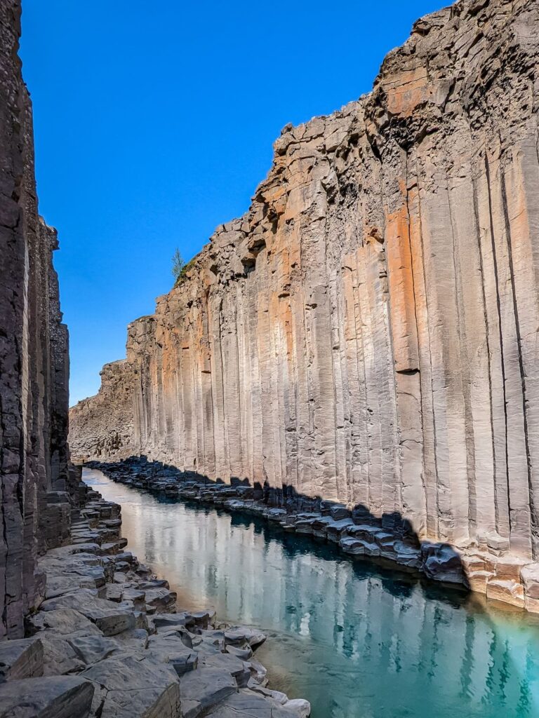
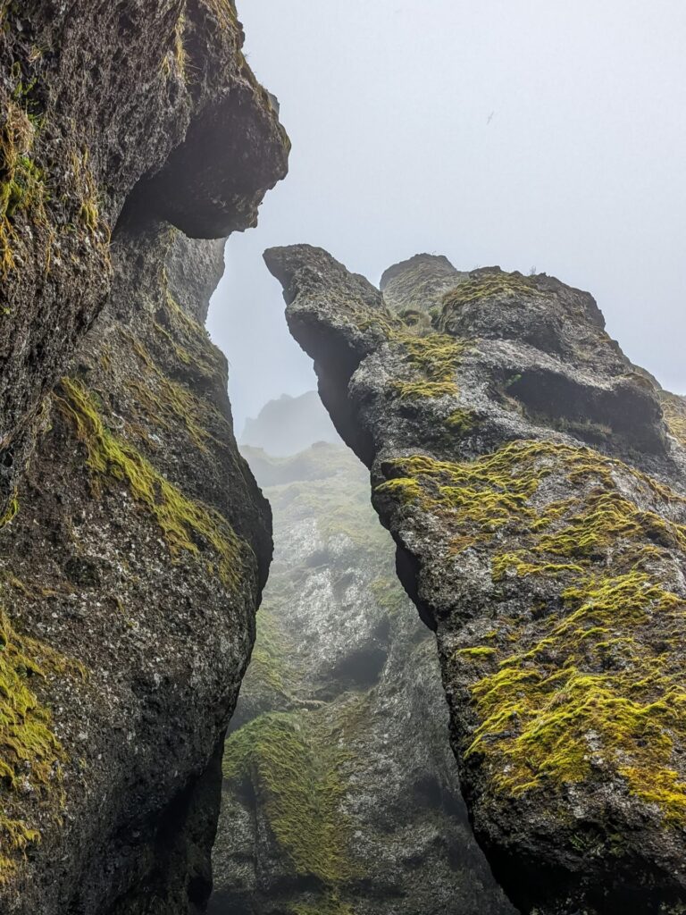
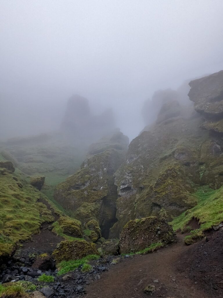
The next stop is 📍Fjaðrárgljúfur Canyon. This canyon was featured in Game of Thrones and is a must-visit; it’s really striking. This stop has two parking areas. One is paved and easy to get to but will require a short uphill hike to the best viewpoint. The second parking area is up a narrow, bumpy dirt road, but it will put you right next to the third viewpoint and waterfall.
The canyon has a whole metal walkway system, so you don’t deviate from the path, but it gives you a great view down the canyon!
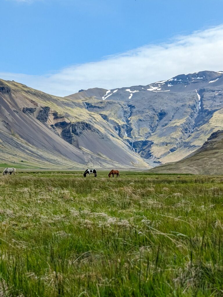
After the canyon, head towards Vatnajökull, Iceland’s largest glacier. You can stop at a few waterfalls along the way to the next major location, but you are headed to a waterfall, so don’t feel like you have to stop at these.
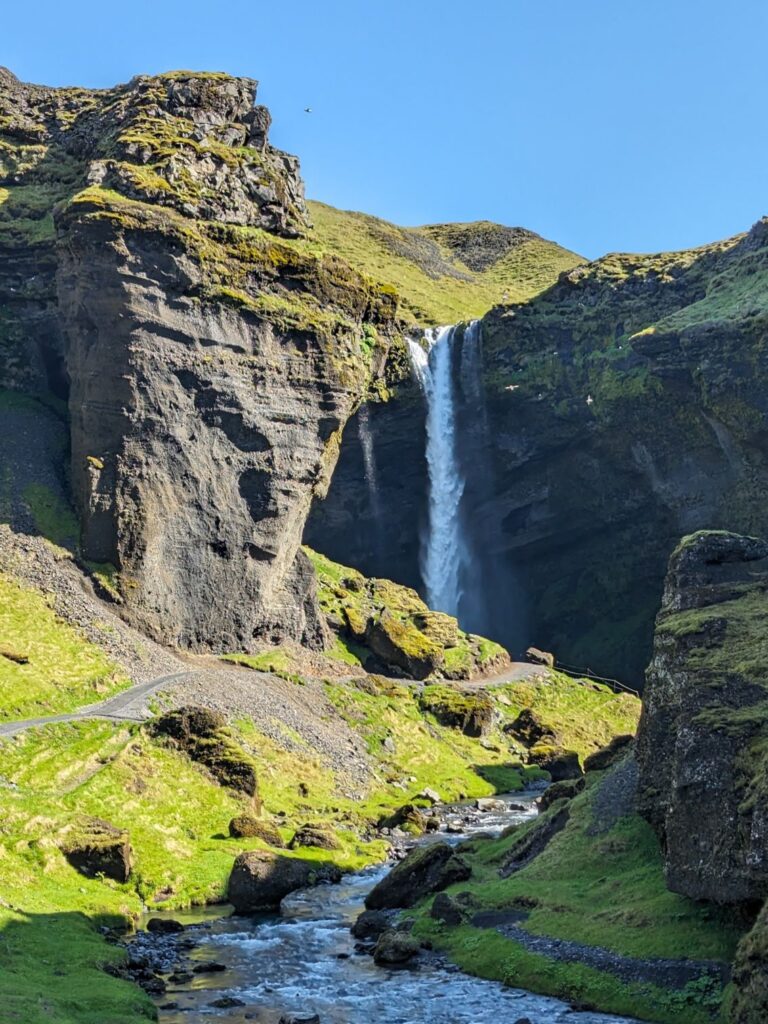
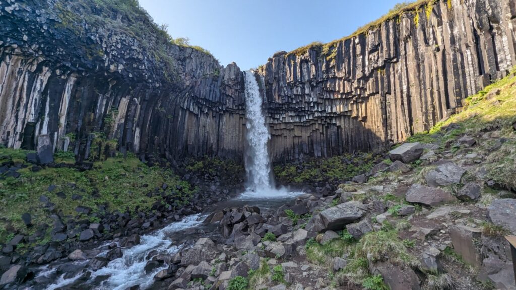
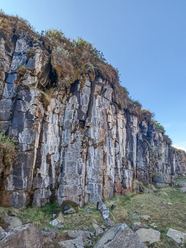
This next stop involves hiking and was one of my favorite stops on the South Coast! Park at Skaftafell & Svartifoss Parking and make your way towards the 📍Svartifoss Trailhead. This trail is a 2-mile (3km) out-and-back and takes you to two waterfalls. The second waterfall, Svartifoss, is the more iconic, cascading over a basalt column cliff. This is a pretty popular waterfall, so expect crowds on the viewing platform.
If you’d like to get a bird’ s-eye view of the 📍Skaftafell Glacier, you can make this hike a 4.6-mile (7.4km) loop. Heading back from Svartifoss, you want to take the S6 and S5 trails to loop by the glacier and back to the start.
Or you can hike back to the start of the Svartifoss trail and then hike along the 2.9 (4.6km) mile out-and-back trail to the same glacier but at ground level! With so many options, you can definitely spend a lot of time exploring the area.
Enjoy your drive continuing east along Route 1 and take in all of the beautiful glacier views. This area is stunning!
If you haven’t had enough hiking and canyons, you can stop at 📍Mulagljufur Canyon. The parking area is about a 10-minute drive up a dirt road, and then the hike to the canyon is about 2 hours round trip if you visit the viewpoint at the peak. You can continue beyond the viewpoint, bringing the round trip to nearly 4 hours. The full hike is about 3.6 miles (5.8km) out and back and is considered difficult.
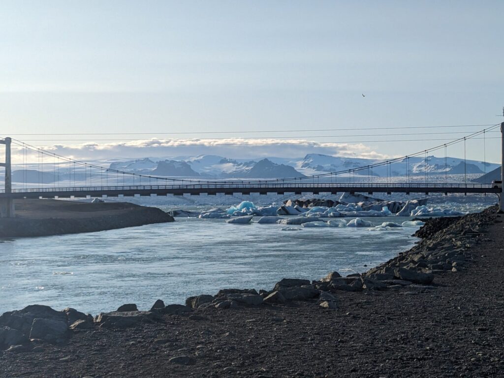
Our next stop is 📍Jökulsárlón, the Glacier Lagoon. If you didn’t hike Mulagljufur Canyon, you likely have plenty of time to go on a boat tour of the lagoon. You should book this in advance! The boat tour is the one thing I’m sad we missed out on due to our one-day rush through the South Coast. The lagoon is really beautiful, and I would have loved to spend more time here and get closer to the icebergs and glaciers!
If you do not take a boat tour, you can still walk quite a long way along the shore.
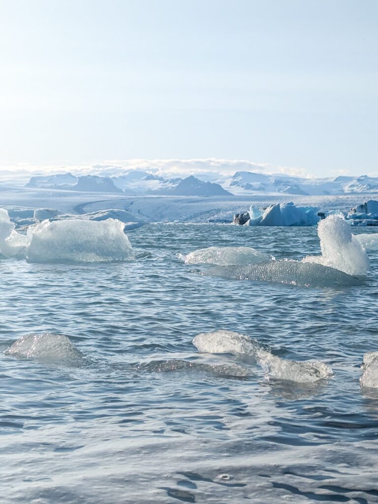
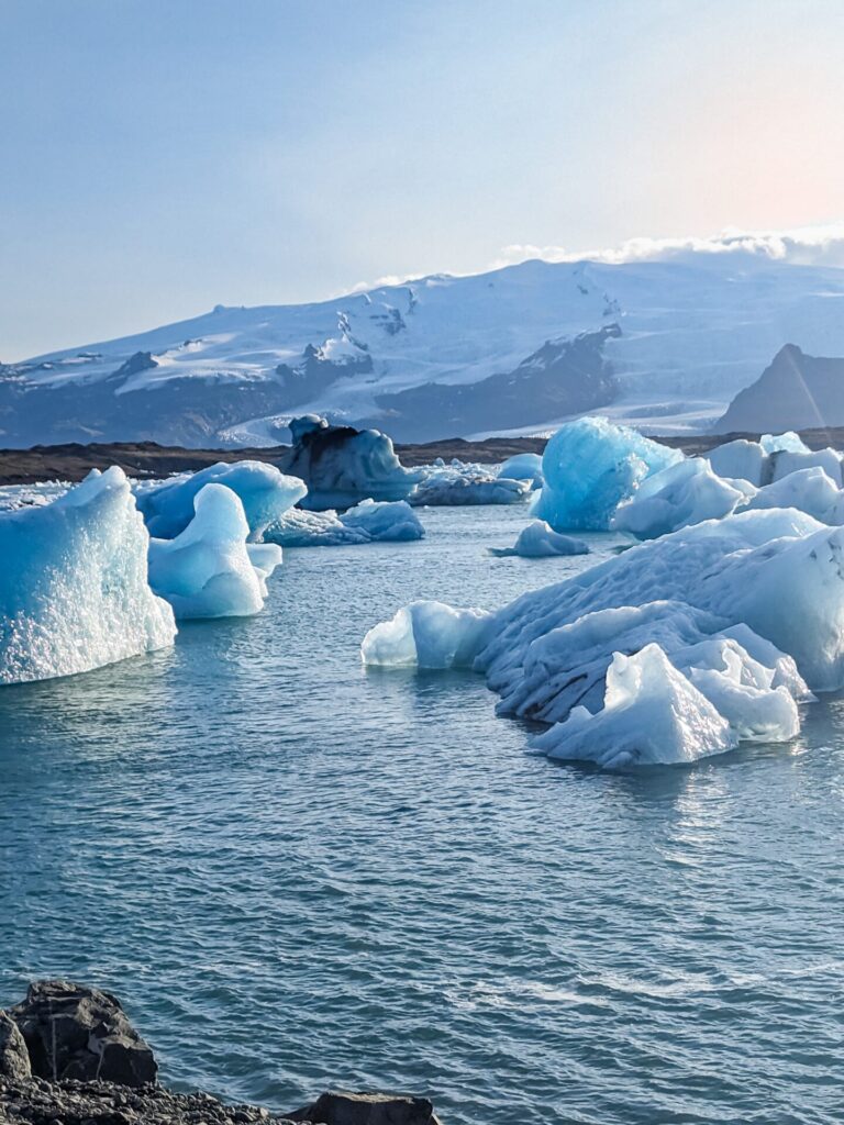
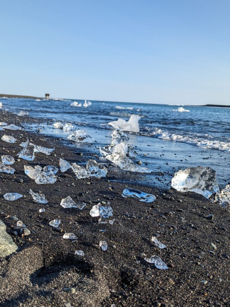
Right across the street from Jökulsárlón is the famous 📍Diamond Beach. It’s a black sand beach that has been featured in several movies. The ice floating from the lagoon into the ocean is washed back onto this beach. If you get lucky, you will find large chunks of ice on the beach that look like huge diamonds, and you can walk right up to them!
Things to do along the South Coast (Vik → Höfn):
- Visit the Yoda Cave and see the lupine flowers
- Stop for photos of the mossy lava field
- Check out the three viewpoints at Fjaðrárgljúfur Canyon
- Hike to Svartifoss
- Continue your Svartifoss hike to the Skaftafell Glacier viewpoint
- Trek into Mulagljufur Canyon
- Take a boat tour at Jökulsárlón
- Walk among the diamonds at Diamond Beach
- Enjoy glacier views as you drive the south coast
Where to Stay on the South Coast
- Lambhus Glacier View Cabins
- Lilja Guesthouse
- Fosshotel Vatnajökull
- Milk Factory
- Old Airline Guest House
For your second night on the south coast, I recommend staying somewhere on the east side of Vatnajökull. Look for cabins and guesthouses just before Höfn. This area is really beautiful, and it is worth the splurge to stay in one of the cabins here. The only downside is there is no immediate access to food, so make sure you have a dinner plan. We stayed at Lambhus Glacier View Cabins, and I highly recommend them; they have beautiful views.
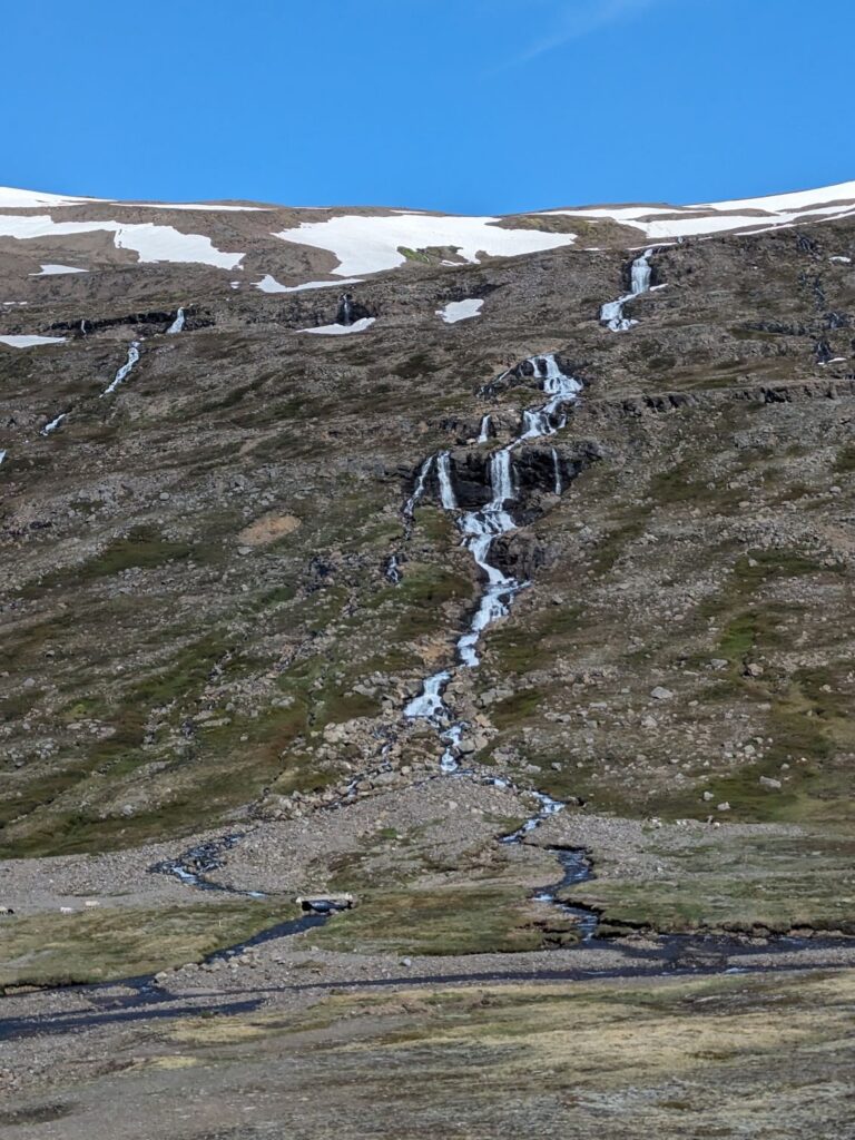
Day 5: Eastfjords
Driving Time: Approximately 3.5 hours (4.8 hours with Seyðisfjörður) | Ending Location: Egilsstaðir
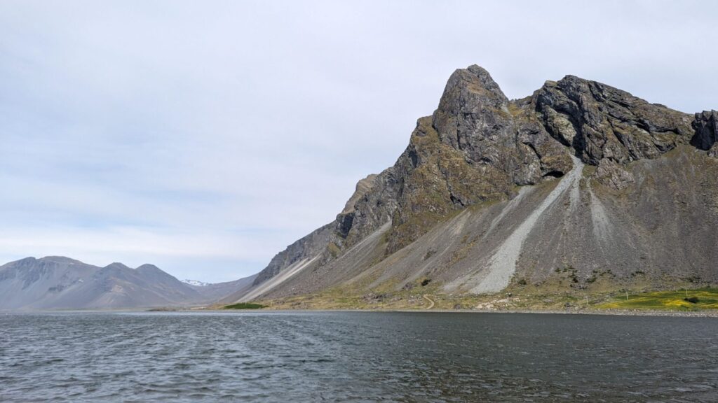
After two busy days on the south coast, it’s time to slow down and enjoy the drive through the Eastfjords. There are some short hikes and waterfalls you can visit, but most of the Eastfjords can be enjoyed from the driver or passenger seat!
If you stayed the previous night near the glacier, consider stopping in Hofn for breakfast. We visited 📍Hafnarbuðin, and it was a great way to start the day.
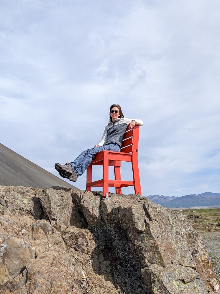
There are a few optional stops along this section of the drive, but there are mostly a lot of viewpoints. The first stop of the day is a silly one. There is a large 📍Red Chair on top of a rock just off the side of the road. It’s just a fun place to take a picture and stretch your legs while enjoying the view.
If you’d prefer, your first stop can also be a waterfall, 📍Skútafoss, which is almost right across the street from the red chair. It’s a short walk to the main falls from the parking area. Don’t get distracted by the waterfall near the parking area; continue on the path to the real waterfall!
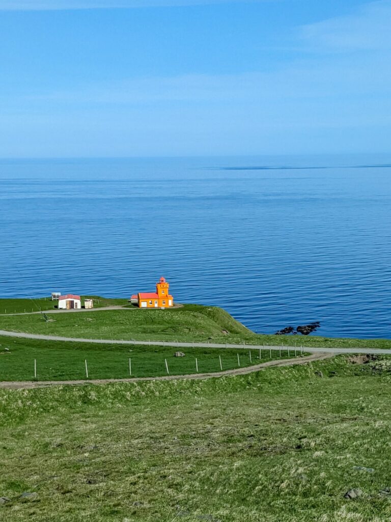
If you are looking for another location to get out and stretch, you can check out the 📍Hvalnes Nature Reserve Beach or the 📍Hvalnes Lighthouse; both have great ocean views. You can also skip some rocks at the Hvalnes Nature Reserve Beach.
One stop I really do suggest that has a great view is 📍Fauskasandur. From the parking lot, you can walk out near the beach and climb up onto an area that will give you a great view of the beach on both sides, including some cool rocks out on the beach/in the water.
After this point, there are a few waterfalls that you can see during your drive as you wind through the coast. Stop in 📍Djúpivogur for some lunch! The restaurant we ate at may not be open anymore, but if it happens to be seasonal, it was called Við Voginn and was pretty tasty.
If you didn’t stop in Djúpivogu, there is the 📍Teigarhorn Natural Monument and Nature Preserve just a little ways further along Route 1. This is a nice place to stop for a walk around the many paths and take in the view. Otherwise, continue your drive through the Eastfjords.
There is a waterfall, 📍Nykurhylsfoss, a little further if you haven’t had your daily waterfall fix yet. The parking lot is quite close to the falls, you just have to take a short path from the parking lot of the viewpoint. There is a second viewpoint higher up if you’d like to spend some time here; just cross the bridge and continue on the path for the second view.
As previously mentioned, most of the Eastfjords are scenic and can be viewed from the car as you drive. There are some pullouts for scenic stops, but my next suggested stop isn’t for quite a ways and is completely optional.
There are two small stops in quick succession. 📍The Bird Watching House, which is a small grass-roof hut on the shore of the inlet, where you can enter and watch the seabirds in the area.
The second stop is a bit of a quirky one; it’s 📍Petra’s Stone Collection. Basically, it is a garden with a huge collection of rocks. If this doesn’t sound like something you’d be interested in, continue your scenic drive. You can get a glimpse of the collection as you drive by.
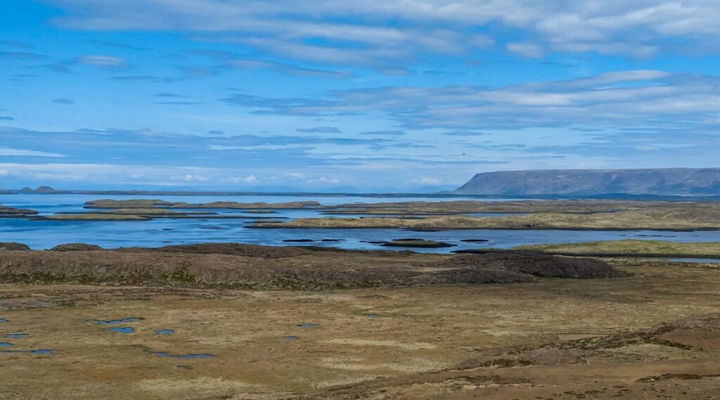
From here, enjoy your drive to 📍Egilsstaðir. If you didn’t stop at the two previous stops, you can choose to take the shorter route up Route 95 rather than staying on Route 1. It will save you some time and is said to be the more scenic of the two routes. Either way, you will see a bunch of waterfalls up in the mountains as you drive.
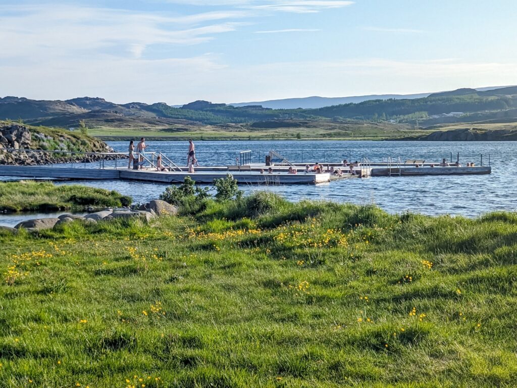
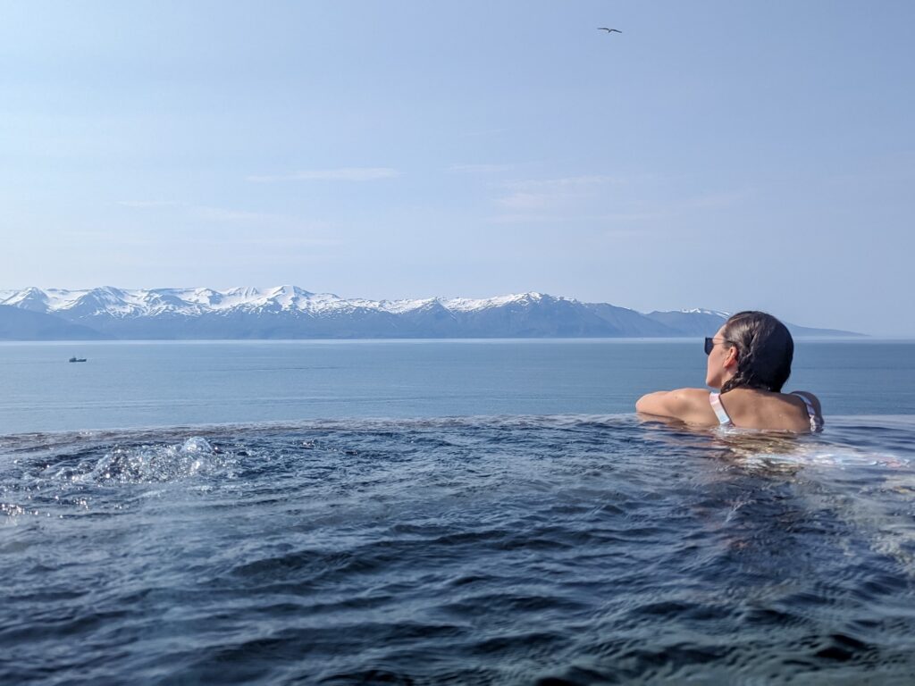
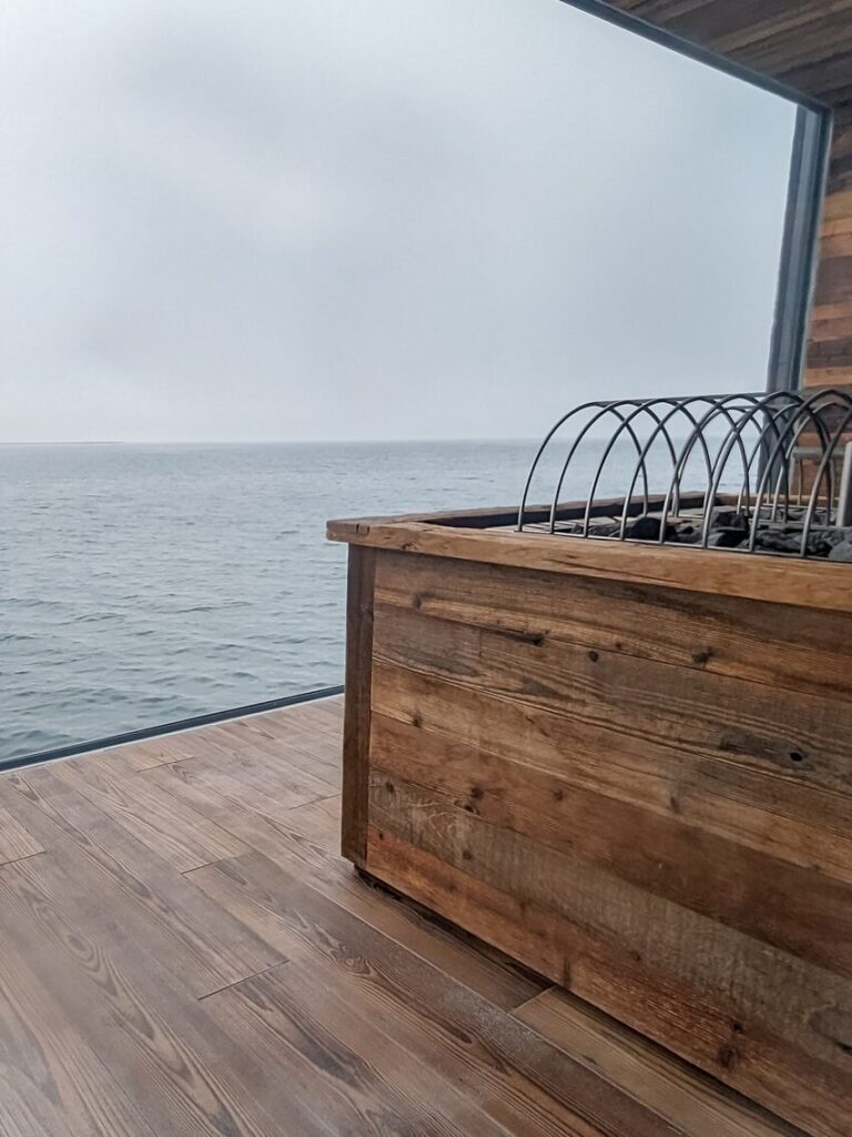
Once you’ve reached Egilsstaðir, you can wind down and go for an evening soak at 📍Vök Baths, a geothermal bath that floats on a lake. Or, you can take a small detour from the Ring Road and make a scenic drive east to 📍Seyðisfjörður.
Seyðisfjörður is home to the famous little blue church 📍Seyðisfjarðarkirkja, with the rainbow road leading up to it. The town itself is very quaint, with a large lake surrounded by snow-capped mountains. It is very picturesque. You may want to get dinner here and enjoy the views. There are also a couple of waterfalls to stop at on the drive if you are interested!
Things to do in the Eastfjords:
- Stop at the Red Chair for a silly picture
- Take some gorgeous photos at Fauskasandur
- Visit the Teigarhorn Natural Monument and Nature Preserve for a walk along the coast
- Stop at Nykurhylsfoss for your daily waterfall fix
- Watch some birds at the Bird Watching House
- Check out Petra’s Stone Collection and garden
- Enjoy the views while you drive!
- Take a side trip to Seydisfjordur and see Seyðisfjarðarkirkja and the rainbow road
- Enjoy an evening soak at Vök Baths
Where to Stay in the Eastfjords
- Hérað – Berjaya Iceland Hotels
- Arctic East Apartment Egilsstaðir
- Gistihúsið – Lake Hótel Egilsstaðir
There are quite a few places to stay in Egilsstaðir and just across the river where there are a bunch of different cottages and guesthouses. You shouldn’t have a problem finding one that suits you! We stayed at Hérað – Berjaya Iceland Hotels.
Day 6 Northern Iceland (Egilsstaðir → Húsavík)
Driving Time: Approximately 3.1 hours | Ending Location: Höfn
Today is a day that you will definitely want to start early. To make the most of the first major stop, you should be there before 9 AM.
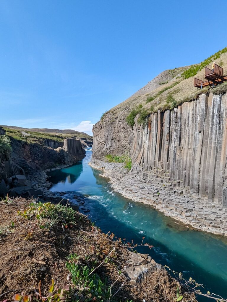
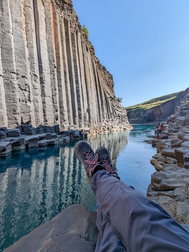
Head east along Route 1, and there will be a waterfall that you can pull over to hike up to, 📍Rjúkandi Waterfall. But don’t feel like you need to if you’ve had your fill of waterfalls. You can continue on to one of the day’s highlights, Stuðlagil Canyon.
You’ve probably seen photos of 📍Stuðlagil Canyon; it’s a very popular place, which is why I recommend showing up as early as you can, avoiding the crowds, and having the place to yourself if you want photos.
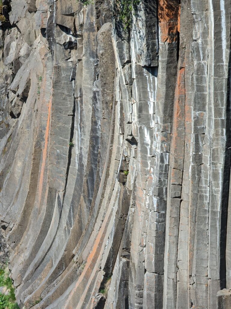
You can visit both sides of the canyon; however, I highly recommend parking on the east side and hiking to the canyon. It’s a bit of a bumpy ride to get there, and the parking lot is small, but it’s completely worth the experience. The hike (more of a walk) is not too long, about 30 minutes each way, and you can walk inside the canyon when you arrive. If you visit the west side, there is only an overlook point, which is quite far from the actual canyon and has a pretty disappointing view.
After you’ve had your fill of the canyon, it’s a long drive until the next stop. During this section, you will likely want to stop for food, and there aren’t too many options. I suggest stopping at 📍Beitarhúsið and trying their lamb soup; it’s really tasty.
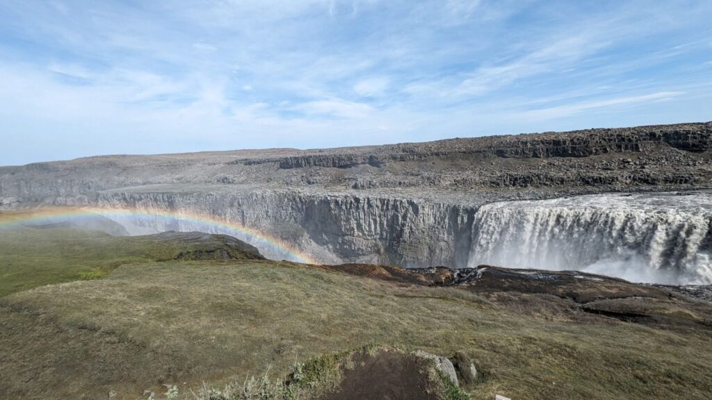
After filling up the soup, the next stop is 📍Dettifoss. This is another stop where you can visit both the east and west sides. The east side has the better view, but the road (Route 864) is a lot rougher and takes a lot longer. The west side has a paved road (Route 862) with a large parking area and multiple viewpoints, even though the overall view isn’t quite as good. I’d personally suggest the west side just from a time-saving perspective.
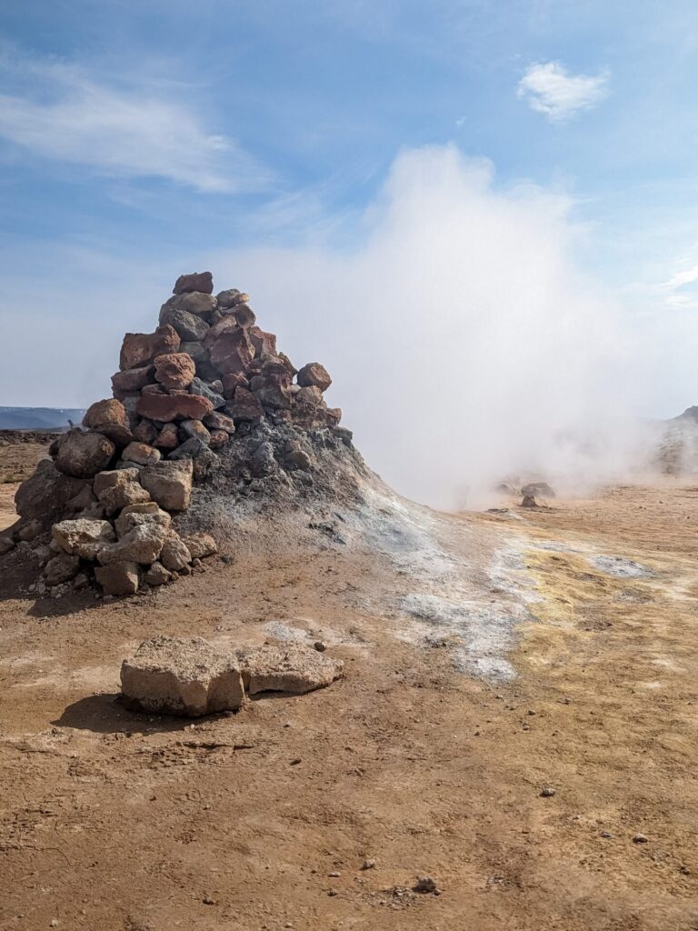
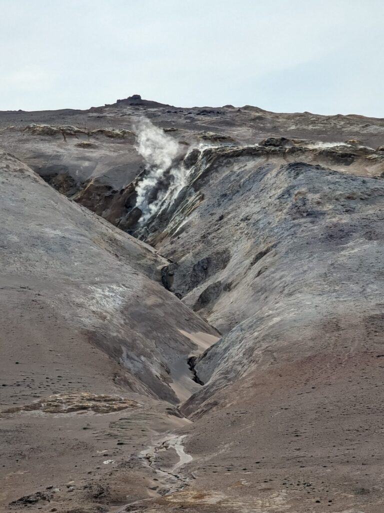
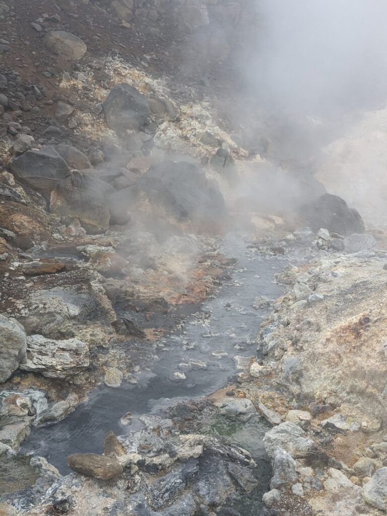
Next, continue west on Route 1 to the Mývatn geothermal and lake area! First up in this area is 📍Hverir, the actual geothermal area full of bubbling mud pools and steamy sulfur. This stop is pretty strong-smelling, and there is a parking fee (1,200 ISK), but it is pretty neat! If you want to skip this particular one, there are options on Day 10 for other areas like this.
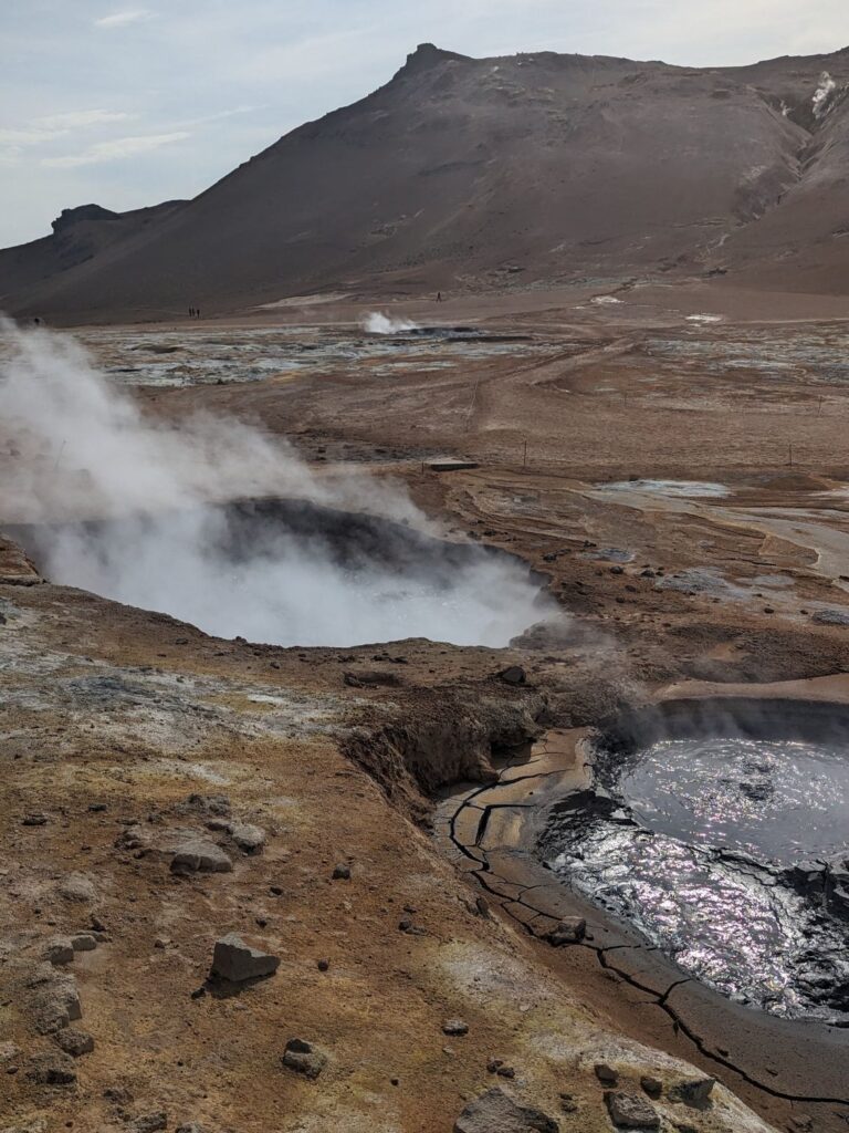
There is also another geothermal hot spring here, 📍Mývatn Nature Baths. This one is more similar to the Blue Lagoon; the waters are milky blue and full of silica. If you’d like to visit, make sure you book a mid-to-late afternoon timeslot. I personally would skip this location, as it was my least favorite of the five geothermal pools we visited.
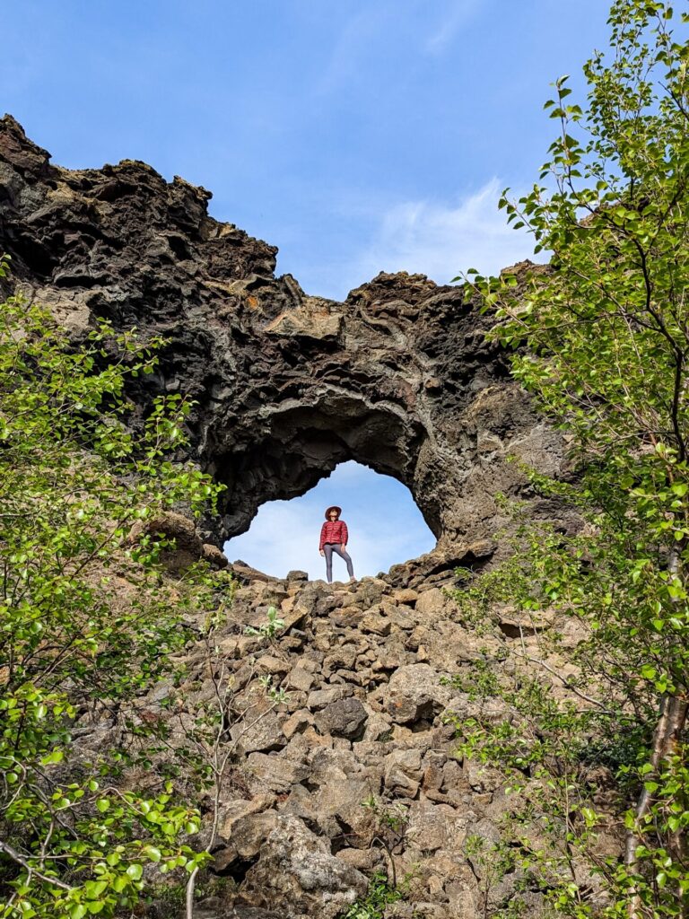
It’s time to head into the 📍Lake Mývatn area, with a possible quick stop at 📍Grjótagjá. This one is mostly for Game of Thrones fans. Grjótagjá is the Jon Snow and Ygritte cave. You can climb in at your own risk; however, do not enter the water; it’s far too hot these days and will severely injure you.
You should now have arrived at the lake! There are multiple viewpoints along the lake where you can stop or enjoy the area from your car!
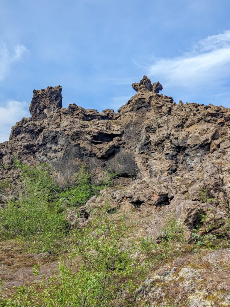
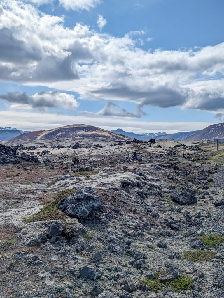
Another optional stop is 📍Dimmuborgir Lava Field, which has hiking trails through a really cool lava field. It’s definitely worth exploring if you have time, but you shouldn’t need to spend more than an hour here.
One final stop along the lake is 📍Skútustaðagígar. This area is full of pseudocraters formed from lava flows. I once saw someone call these pseudocraters earth pimples, which made me chuckle, and now that’s how I always refer to them. Make sure you have a bug net for your head if you visit; you will be swarmed by midges.
After you’ve had your fill of Lake Mývatn, make the drive north on Route 85 or Route 87 to 📍Húsavík. Spend some time exploring the town, which is easily walkable, and grab some dinner at 📍Naustið, one of my favorite restaurants from our trip!
This is a heads-up for Day 7. There will be a GeoSea stop mid-day. However, you can also do that on today on Day 6 if you are interested in a nighttime geothermal bath experience or if you don’t think you will have time on Day 7.
Things to do in Northern Iceland (Egilsstaðir → Húsavík):
- Take a short hike up a hill to see Rjúkandi Waterfall
- Hike to Stuðlagil and take in the view from inside the canyon
- Stop for lunch at Beitarhúsið
- Visit the west side of Dettifoss and catch a rainbow in the mist
- Check out the bubbling mud pools and steam at Hverir
- Soak in the bright blue silica waters at Mývatn Nature Baths
- Hike the many trails at Lava Field Dimmuborgir
- Stop for a scenic view of Lake Myvatn
- Walk through the small town of Húsavík
- Enjoy dinner at Naustið
Where to Stay in Húsavík:
Húsavík is a cute little town with a lot of options for accommodation; you should be able to find the perfect place to stay, which will allow you to walk all over the town. We stayed at the Skjálfandi Apartments, which were very spacious and within easy walking distance of everything.
Looking to Visit a Hot Spring in Iceland?
Check out 15 Hot Springs and Geothermal Pools in Iceland
Day 7: Northern Iceland (Húsavík → Blönduós)
Driving Time: Approximately 2.75 hours (4.25 hours on the scenic route) | Ending Location: Blönduós
There are two ways to approach Day 7 on the Ring Road: You can take the direct route along Route 1 or the scenic route through the Tröllaskagi Peninsula.
There are not too many stops along the scenic route, so if you are not interested in driving the coast for a couple of hours next to some impressive mountains, you may want to take the direct route. Depending on how much time you spend in Húsavík in the morning, you may also feel like you do not have the time to take the scenic route.
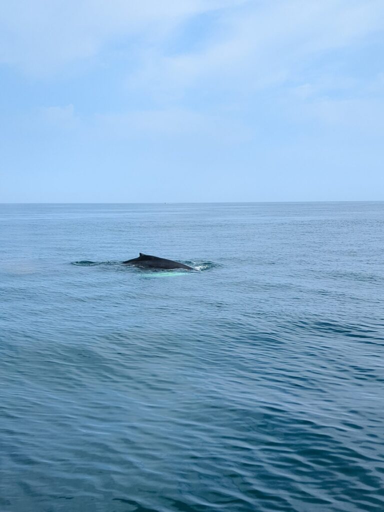
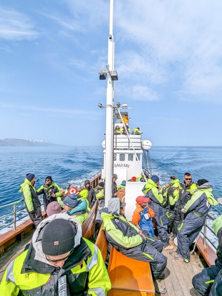
With that in mind, you should start your day in Husavik with a whale-watching tour. After all, Husavik is the whale-watching capital of Iceland; it would be a shame to visit and not see some whales. You will likely visit 📍Flatey on your tour, so you can see puffins as well. Start your whale-watching tour as early as possible so that the remainder of your day does not feel rushed. We went on our tour with North Sailing.

After your whale-watching tour, either grab some food or head to 📍Geosea for a geothermal bath to warm up after spending a few hours on the windy ocean.
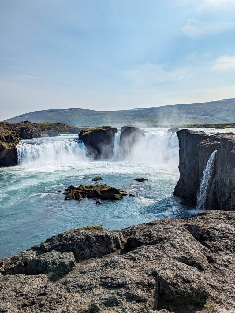
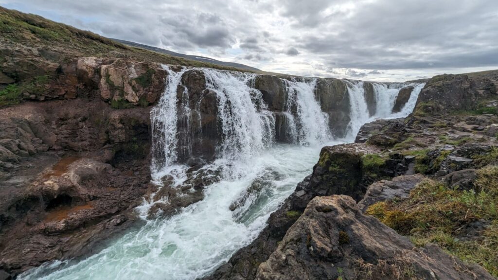
After you’ve had your fill of Husavik, head south back to the Ring Road. Once back on the main road, you will quickly stop at 📍Goðafoss. This is another waterfall that you can visit both sides of and get pretty close to from the east side. Unlike many other waterfalls, you can easily visit both sides in a short time. While we were here, we saw people kayaking off the waterfall, which was pretty neat.
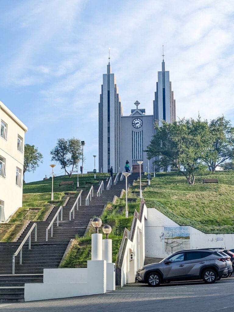
From Goðafoss, it’s time to head to Akureyri, the “Capital of North Iceland.” Akureyri is going to be the largest city you’ve seen since Reykjavik. Heading into Akureyri, you will either have to pass through the toll road Vaðlaheiðargöng tunnel or head north along a scenic route (Route 84 & 83) to avoid the tunnel.
Once you are in Akureyri, spend some time walking around, shopping, and finding some tasty food. We enjoyed visiting the 📍Akureyri Botanical Garden and 📍Akureyrarkirkja, and we ate at 📍Mulaberg Bistro & Bar.
If you have an extra day on your trip, you can spend the night in Akureyri and spend more time exploring the local area. Then, you certainly will have plenty of time the following day for the scenic route through the Tröllaskagi Peninsula. If you go with this option like we did, we stayed at FE GISTING.
Now is the time to decide if you want to drive north into the 📍Tröllaskagi Peninsula. If you aren’t interested, stay on Route 1 and continue east. For the sake of this itinerary, we are heading into the Troll Peninsula via Route 82!
The Troll Peninsula is mostly a scenic drive with a couple of scenic stops, a few interesting gems, and some cute towns. The peninsula is also home to the tallest mountains in Iceland outside of the highlands, so basically, the tallest mountains you will see if driving the Ring Road!
The first town you will arrive in is 📍Dalvik, but don’t feel like you need to stop. There are a couple of other towns that are worth stopping in and have places to visit!
The first town you should stop in is 📍Siglufjörður, a cute little fishing town that is home to 📍The Herring Era Museum. The museum has five exhibits and is Iceland’s largest maritime museum. It details the history of herring fishing in Iceland and the role it played in the country’s economy. The entry fee for adults is 2200 ISK.
Shortly beyond Siglufjörður is the northernmost section of the drive along the Troll Peninsula. There is a viewpoint and a lighthouse to stop at; otherwise, continue south along the fjord.
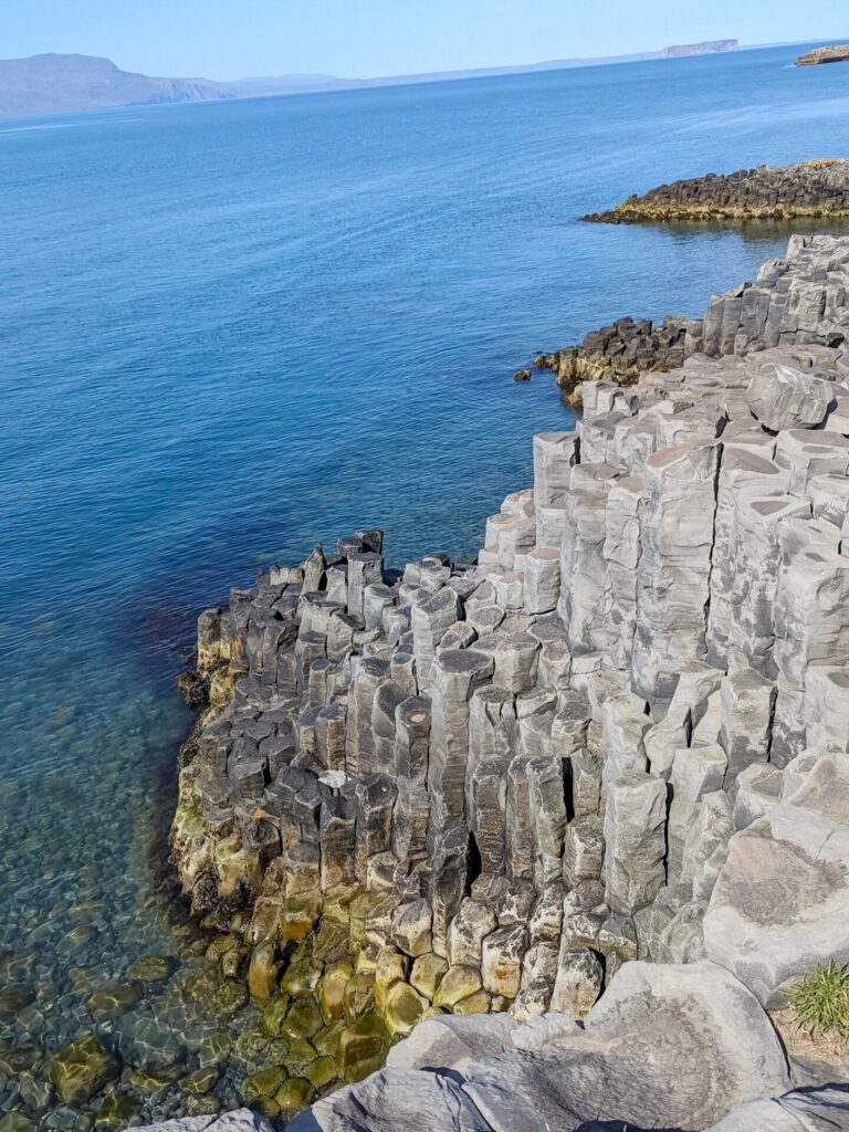
Next up is the town of 📍Hofsós, which is a super cute little town and also one of the oldest trading ports in northern Iceland. There are some basalt column cliffs here to stop at, as well as a local swimming pool, 📍Hofsós Sundlaug, with an amazing view of the fjord. You can also visit a cute little church right across the street from the pool and cliffs.
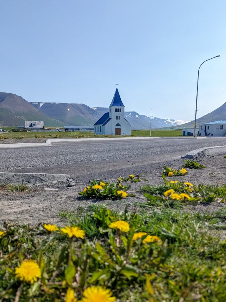
Shortly south of Hofsós is 📍Grafarkirkja, Iceland’s oldest church, a grass-roof wooden church. We actually missed the turn for this one and couldn’t quite figure out where to stop, so if this happens to be of interest to you, take the drive slowly so you don’t miss the stop!
Continuing south, you will enter the town of Varmahlíð. It’s around this area that the roads converge back to Route 1, so if you skip the Troll Peninsula, everything is fair game from here onward!
However, instead of continuing along Route 1, take a small detour south along Route 752 to visit 📍Reykjafoss. The turnoff (Route 753) is really easy to miss, so keep your eyes open. It’s on the east side of the road, and then you will have to make a short, bumpy drive to the parking area. The falls are easy to access from that point, and there is even a natural geothermal hotspot at the top of the falls called 📍Fosslaug.
After finishing at the falls, head west on Route 1 to 📍Blönduós, where you should stop for the night at a guesthouse.
Things to do in Northern Iceland (Húsavík → Blönduós):
- Start the day with a Whale Watching tour in Húsavík
- Warm up by soaking at Geosea – Geothermal Sea Baths
- Visit both sides of Goðafoss
- Stop for lunch in Akureyri
- Walk through the city of Akureyri, visit Akureyrarkirkja and the Botanical Garden
- Take a scenic drive through the Troll Peninsula
- Visit the oldest church in Iceland
- Check out the natural hot spring, Fosslaug, at Reykjafoss
- Enjoy a dinner at your guesthouse in Blönduós
Where to Stay in Blönduós
- Brimslóð Atelier Guesthouse & Restaurant
- Guesthouse Tilraun
- Glaðheimar Cottages
- Steinnes
- Hestasport Cottages
Blönduós is a very small town with a few guesthouses to choose from. If you can’t find accommodation, you may need to end the day in another small town or at a guesthouse along the route. We stayed at Brimslóð Atelier Guesthouse & Restaurant, which I highly recommend. Definitely opt for the dinner and breakfast that the hosts prepare; it’s delicious!
Day 8: Northern Iceland & Snæfellsnes Peninsula (Blönduós → Grundarfjörður)
Driving Time: Approximately 4 hours | Ending Location: Grundarfjörður
We are once again going to be leaving the Ring Road today and heading into the Snæfellsnes Peninsula. If you aren’t interested in the Snæfellsnes Peninsula, it’s okay to continue along Route 1 and back to Reykjavik; this will save you a day if you are short on time. However, in this itinerary, I will be taking you through the Snæfellsnes Peninsula.
Start the day by continuing along Route 1; the first stop will be the 📍Vatnsdalshólar View Point, a scenic stop with a great view of the valley and surrounding mountains.
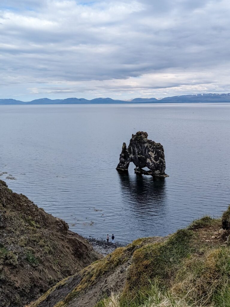
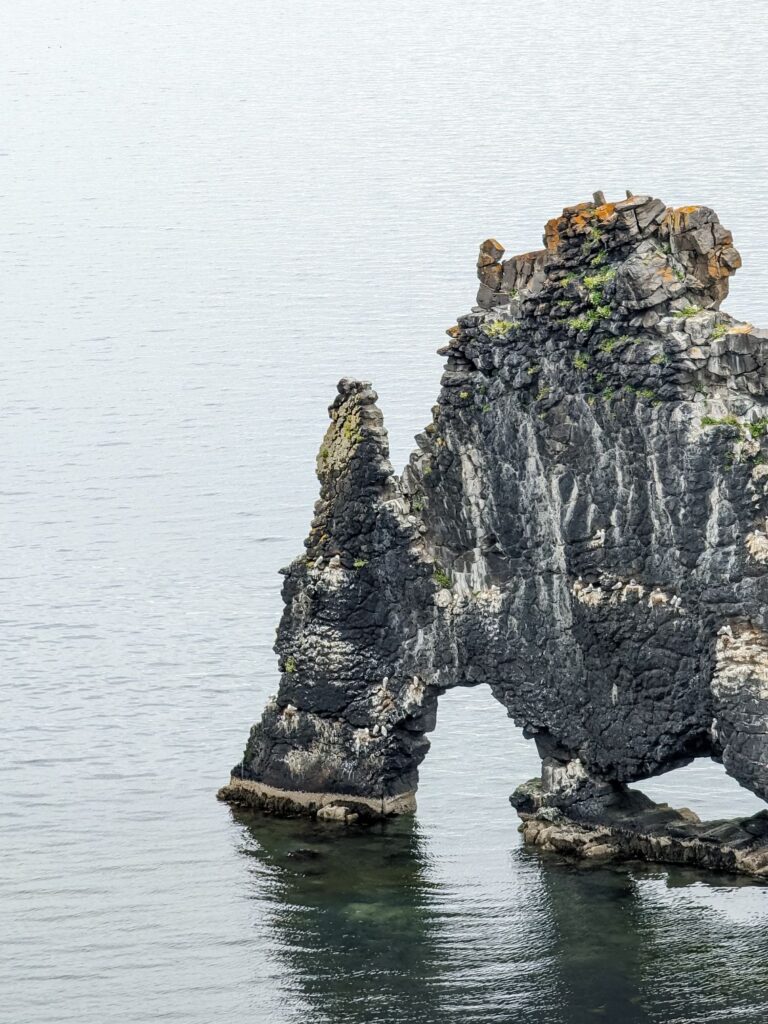
After the viewpoint, take a short detour north along Routes 716, 717, and 711 to get to 📍Hvitserkur. Hvitserkur is a basalt rock just off the shore of the black sand beach. When the tide is out, you can head down the cliffside path to the shore and walk up to the rock feature.
Make your way back the way you came, continuing on Route 1 until you reach the turnoff of Route 715, which will take you to 📍Kolugljúfur Canyon. I found this stop to be such a gem on our trip; it’s so easy to get to and really gorgeous in person. You can get super close to the falls, and even though we’d seen a hundred waterfalls by this point, this one was a standout.
After Kolugljúfur Canyon, Route 1 heads south back towards Reykjavik, and the itinerary continues west along Route 59 into the Snæfellsnes Peninsula. You should now be making your way towards the town of Grundarfjörður.
The Snæfellsnes Peninsula is sometimes referred to as “Little Iceland” because it has a little bit of everything. It’s a nice area to recap many of the amazing things you’ve seen while also keeping everything fresh and new.
The next optional stop is the 📍Eiríksstaðir – Viking Longhouse. You can either just stop and walk along the paths and see the area and the longhouse from the outside, or you can pay to go inside the longhouse and listen to the history. I personally don’t think that the stop is worth the price (2700 ISK) of going inside, but if you are looking to stretch your legs, it’s at least a nice area to walk around.
There is a decent amount of time between stops in this section of the north, so enjoy the relaxing views as you drive. One fun place to stop is a location just marked as 📍“Good View” on Google Maps. There is a small parking area, and it actually has a good view! There is also a wrecked boat in the distance called Bootswrack. You can walk out for a closer view, but it’s pretty far.
There are a few optional waterfalls along this stretch, but the next stop I want to specifically call out is the 📍Lava Rock Formations along Route 54. Just off the north side of the road, there is a tiny area to park, and you can walk near the lava field. There are a few signs with some details on the south side of the road.
After the lava field, continue towards 📍Grundarfjörður. Right before you reach the town, there is another waterfall that is worth stopping at, 📍Grundarfoss. There is a small turn-off and parking area to the south of Route 54. You will have to hike through local farmland to get to the waterfall, but there are signs explaining where to walk and how to get to the waterfall.
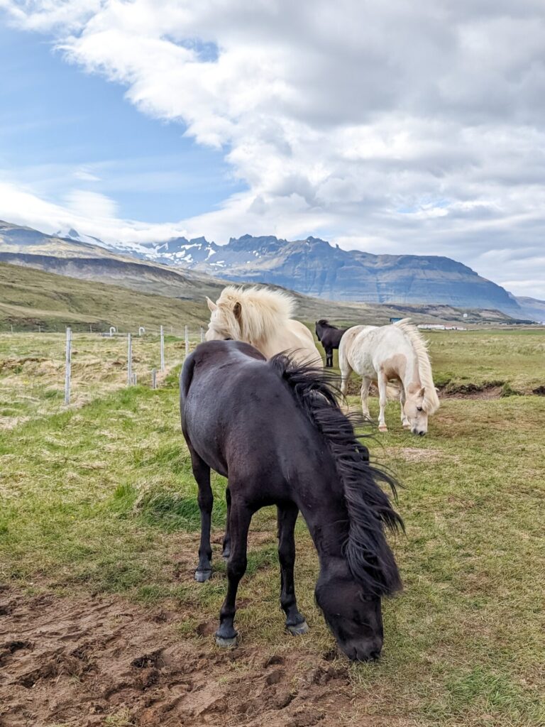
When we visited, there were horses out enjoying the neighboring field. On our walk back to the car, they came running over to say hello. It was quite a unique experience!
At this point, you are very close to Grundarfjörður; make your way into the town, check into your accommodation, and grab something to eat! We stopped at the 📍Mæstro food truck for something quick. They have a variety of hot dogs and other quick foods to choose from, and it was all very tasty. You can always skip Grundarfoss and circle back to it after some food if you are really hungry.
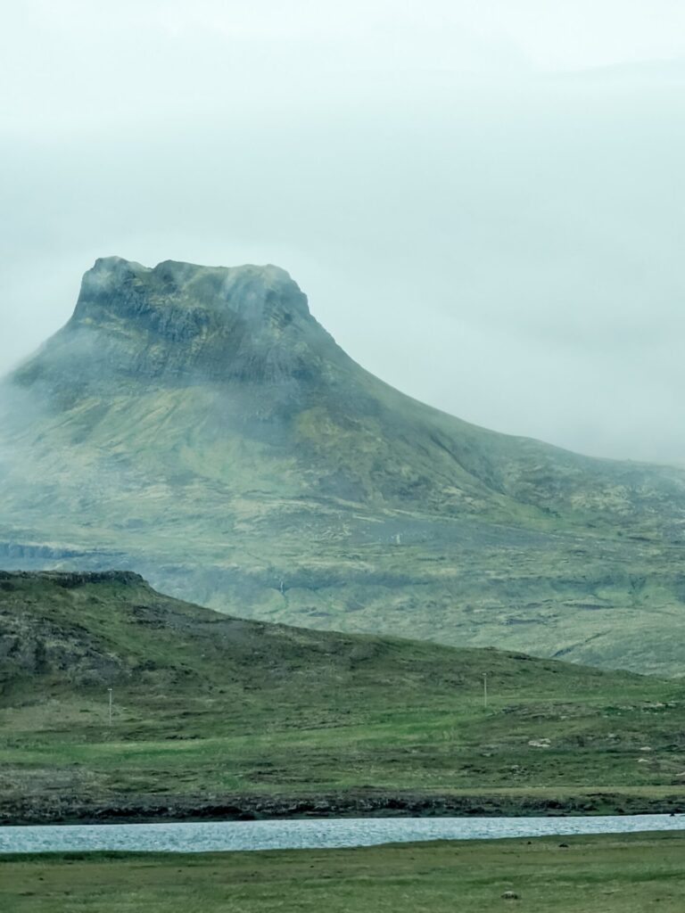
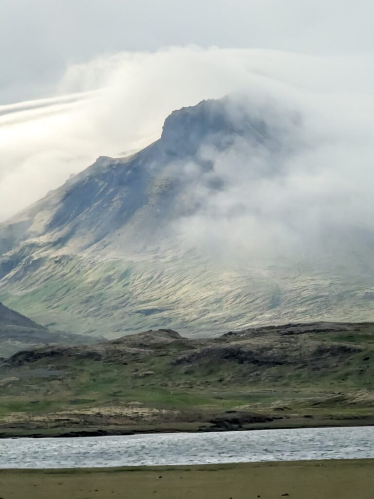
After spending some time relaxing, hop back in your car and head a short distance down Route 54 toward 📍Kirkjufell Mountain. Kirkjufell is a very dramatic mountain right on the northern coast of the peninsula. It’s one of the most photographed and recognizable mountains in Iceland, and it was also featured in Game of Thrones.
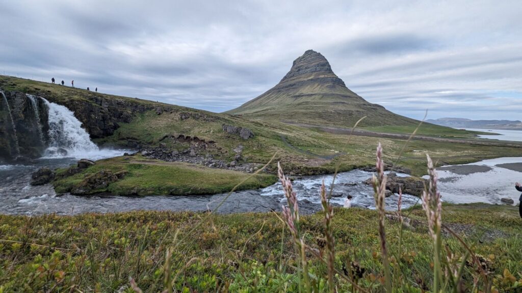
Across from Kirkjufell is a waterfall and lake. When the weather is calm and clear, you can capture a mirror-image reflection of the mountain in the lake. We had no such luck on our trip.
It is also possible to climb Kirkjufell in the summer. However, you should be an extremely experienced and confident mountain climber as the climb is quite steep and difficult. It’s not recommended for most visitors.
Kirkjufell Mountain is the final stop of the day, so enjoy some time exploring the area or relaxing in Grundarfjörður. Consider making a reservation for dinner at 📍Bjargarsteinn Mathús.
Things to do in Northern Iceland (Blönduós → Grundarfjörður):
- Take a small detour for a scenic view at Vatnsdalshólar View Point
- Walk down to the short and see Hvitserkur up close
- Get up close and personal with at the waterfall in Kolugljúfur Canyon
- Check out a replica Viking longhouse at Eiríksstaðir
- See if the “good view” is actually a good view!
- Stop for some photos of Lava Rock Formations
- Take a walk to Grundarfoss; if you are lucky, you may see some horses
- Take a photo of Kirkjufel from the reflection point
Where to Stay in Grundarfjörður:
- Grundarfjörður Bed and Breakfast
- Guesthouse 43
- The Old Post Office Guesthouse
- Hamrahlíð 9 Guesthouse
- Grundarfjörður HI Hostel
Grundarfjörður is small, but there are a surprising number of places to stay in town and some guesthouses just outside of town. You shouldn’t have any problems finding a place to stay. We stayed at Grundarfjörður Bed and Breakfast, which is located above the Harbour Cafe. It was a convenient location to walk around and enjoy food and views of Kirkjufell. However, the parking was a little tight and difficult if you arrived late.
Day 9: Snæfellsnes Peninsula (Grundarfjörður → Reykjavik)
Driving Time: Approximately 3.5 hours | Ending Location: Reykjavik
It’s time to make the most of the last full day of the 10-day itinerary! Head out of Grundarfjörður towards the west coast. The first stop of the day is 📍Bugsfoss, a multilevel waterfall falling over mossy cliffs. There is a short gravel road to a small parking lot, and then it’s a short trek to the falls.
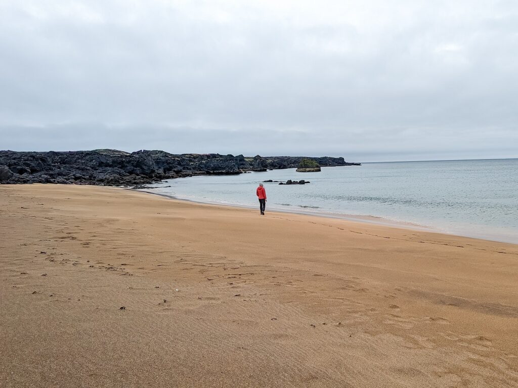
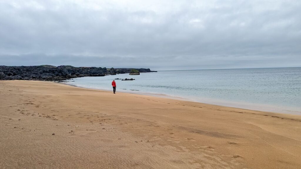
Next up is 📍Skarðsvík Beach; turn off onto Route 579, a gravel road that will take you to a parking area for the beach. Unlike many of the beaches in Iceland, this one is not black sand; it’s golden with turquoise waters and stark black cliffs. A really gorgeous and quiet beach. Keep an eye out for the tide and waves; it can be aggressive.
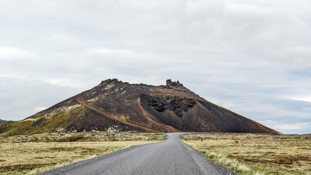
After spending time at the beach, head south to 📍Saxhóll Crater. You don’t necessarily need to stop here, but it is a really neat-looking crater. I think the view of the crater while driving down the road is a lot more neat than actually climbing the dozens of steps to the top of the crater, which is somewhat underwhelming, so don’t feel bad if you just stop here for a few pictures!
As you are making your way through Snæfellsjökull National Park, keep your eyes towards the center of the peninsula for 📍Snæfellsjökull. This glacier-capped volcano is famous for being the entrance to the center of the earth in Journey to the Center of the Earth.
On a clear day, you can even see this volcano from Reykjavik. Hopefully, you get lucky, unlike us. The entire peninsula was covered in fog when we visited, and there was no volcano in sight for us.
While you are scoping out the volcano and glacier, make your way towards 📍Djúpalónssandur Beach. Unlike the first beach stop, this one is a black pebble beach!
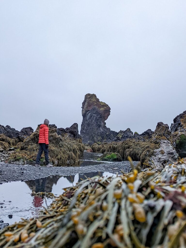
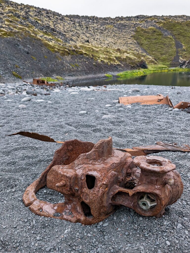
The waves at this beach can be pretty rough, but it’s completely worth the visit. There are so many beautiful rock formations, and the walk down to the beach is gorgeous. There are also the remnants of a decades-old wrecked boat with a sign explaining the story of the boat. It was a highlight of our trip!
Continuing along the route through Snæfellsjökull National Park, there is an optional tour to 📍Vatnshellir Cave. The tour takes you into an ancient lava tube via a subterranean staircase and costs 3750 ISK. We did not go on the tour.
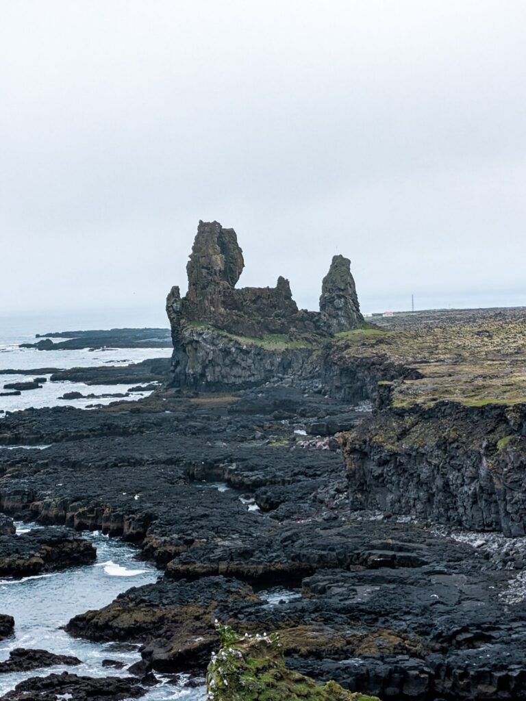
If you love dramatic cliffs and rock features, the Snaefellsnes Peninsula is a dream come true. Next up is 📍Lóndrangar View Point, a pair of basalt towers overlooking the ocean. The entire area is really gorgeous; the only downside is that the cliffs are home to hundreds, if not thousands, of sea birds, so it’s not the most pleasant-smelling stop.
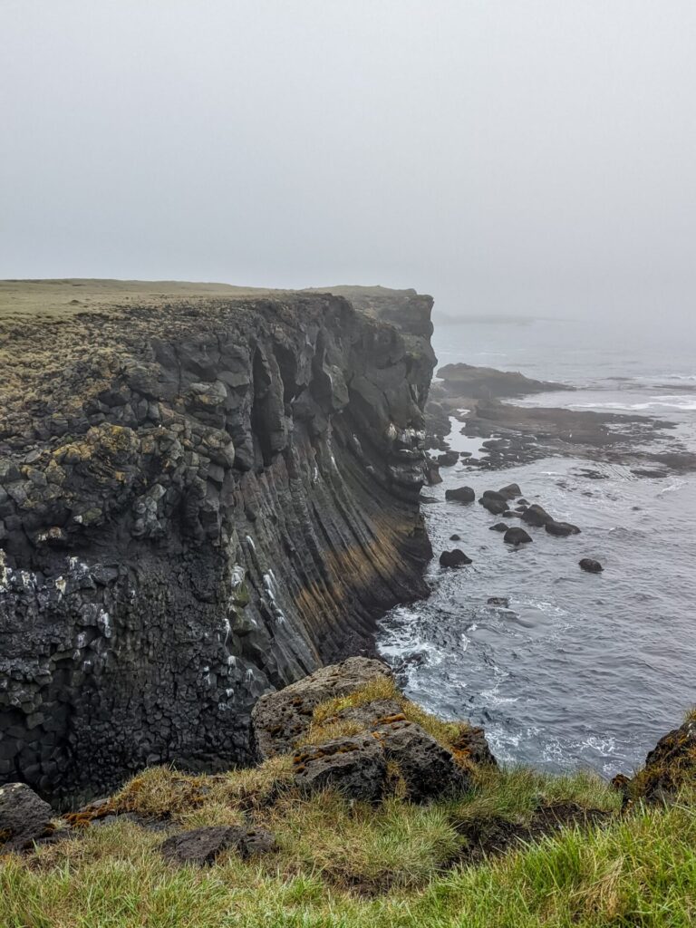
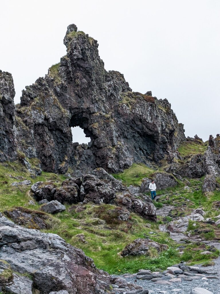
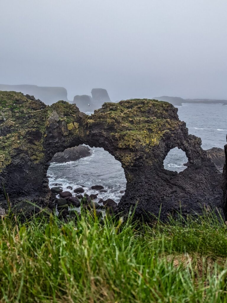
Continuing with the theme of dramatic rocks and cliffs, head to 📍Arnarstapi. This town is home to a stone arch and a stone bridge, the latter of which you can walk onto during a clear, calm day. You will need to make a short walk to both of these stops from the parking area. There are viewpoints for each, as well as a cliff viewpoint. Stay safe if you choose to venture out onto the stone bridge; it can be dangerous. Keep the weather in mind.
Arnarstapi can also be a good place to stop for some food if you are feeling hungry.
After a coastal walk in Arnarstapi, make the short drive north to 📍Rauðfeldsgjá Gorge, one of the favorite stops of our trip. There is a small parking area just north of the road, and then it’s a 20-minute uphill walk to the gorge. You can’t escape the dramatic rocks; this gorge is the definition of dramatic mossy rocks. Make sure you wear your waterproof gear so that you can climb inside the gorge, and if you are feeling adventurous, climb up to the waterfall.
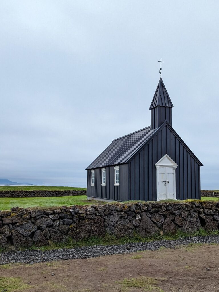
The last few stops are in pretty quick succession; the next two are a little bit farther down the road. First up is the famous photogenic little black church, 📍Búðakirkja. It really stands out against the scenery, and it’s quite a popular stop, so expect a lot of other people here. This is mostly a photo stop, so if that doesn’t interest you, continue to the next stop!
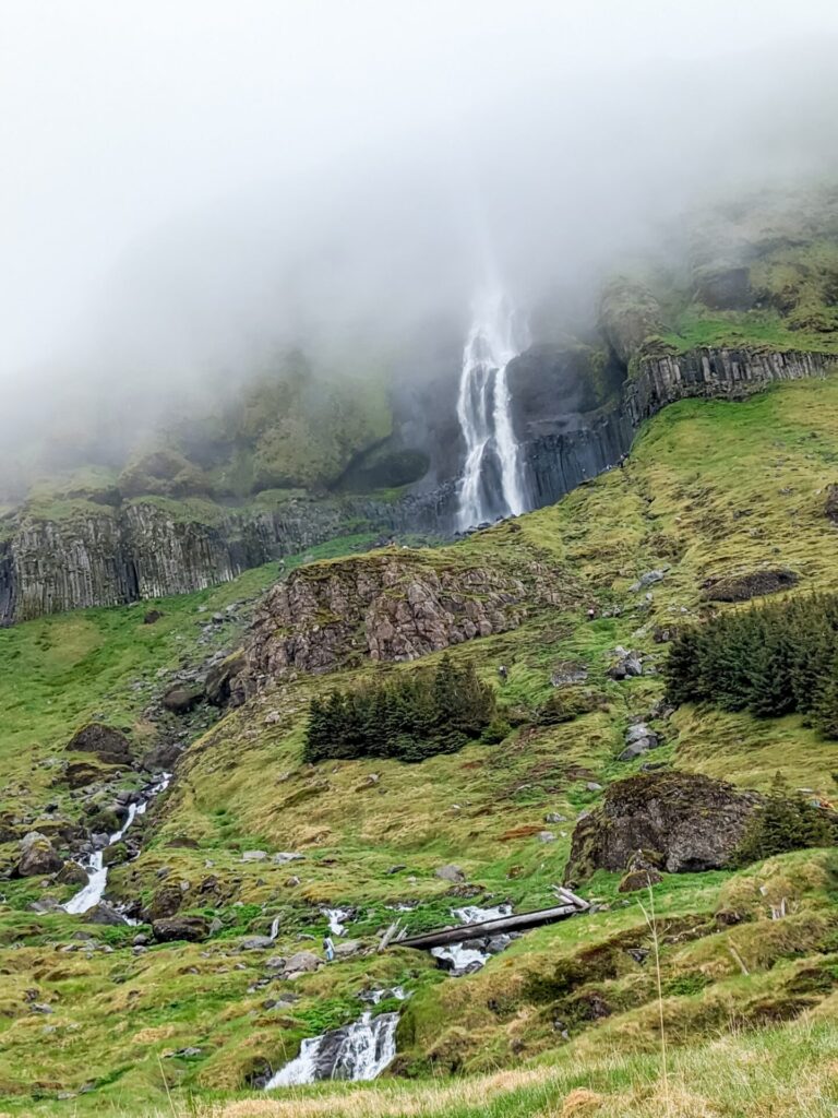
Almost immediately across the main road from Búðakirkja is 📍Bjarnarfoss, a two-tier waterfall that cascades down basalt columns. As you can see from my photo, it was quite foggy during our visit, which made the area quite magical. You can hike up quite close to the falls, though the hike does get a bit steep; just follow the path and cross the little wooden bridge.
That’s it for most of the major stops in the Snaefellsnes Peninsula! As you make your way back towards Reykjavik, you can stop at 📍Ytri Tunga Beach to possibly see some seals. However, the parking fee is 750 ISK, so it may not be worth it.
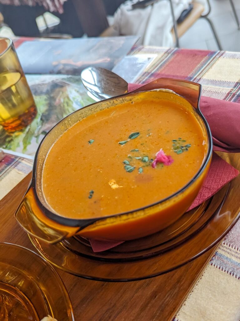
There is a delicious little cafe along the route back to Reykjavik that is worth a stop, 📍Hjá Góðu Fólki. They have amazing fish soup, sandwiches, pizza, and some delicious cakes! The entire atmosphere is magical.
There are a few optional stops on the way back to Reykjavik. First up is 📍Gerðuberg Cliffs. This is a great place if you just want to stretch your legs. You can hike up the side of the cliff. It is a bit steep but quick. You will have a nice view of the area from the top. However, this stop is definitely not a must-visit.
Shortly south, you can stop for a hike to 📍Eldborg Crater. The trail is flat for the most part until you get to the crater, at which point it’s a steep climb up to the rim of the crater. The hike is 1.5 miles (2.5km).
If you are interested in hiking but not the crater, there is another area before Reykjavik that also has some hikes through the wildflowers!
Continue south until you meet back up with Route 1; in a short time, you will drive through Hvalfjörður Tunnel, which goes under the fjord! Once you pop out the other side of the fjord, you can continue the drive and make a stop at 📍Esjurætur – Hiking Center. This is where you can hike through the wildflowers and make a longer hike up Mount Esja.
It’s now the home stretch back to Reykjavik; that’s the entire Ring Road!
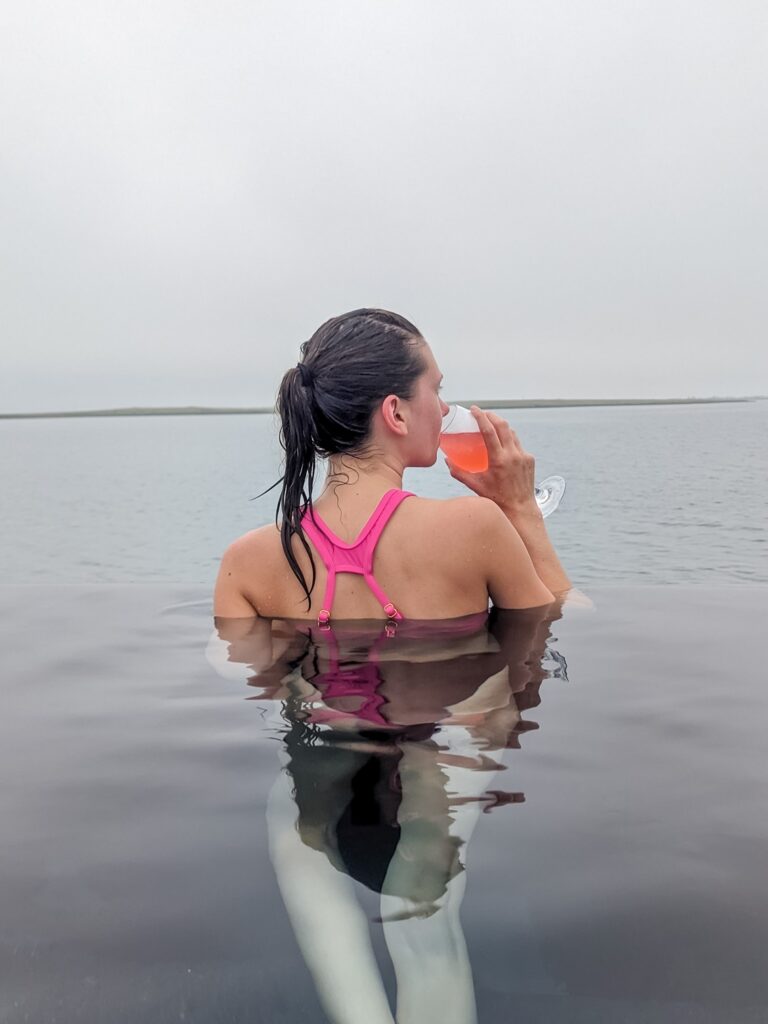
Consider heading to the 📍Sky Lagoon just south of the city to relax and celebrate your journey around Iceland! The Sky Lagoon is known for its Seven-Step Ritual and infinity-edge pool, which looks out over the ocean. This location is newer and very sleek; if you were only visiting one geothermal bath in the area, I would honestly pick stopping here over the Blue Lagoon
Once you are back in Reykjavik for the night, it’s time to explore any areas you missed on Day 1 of the trip and get a good night’s sleep!
Things to do in Snæfellsnes Peninsula (Grundarfjörður → Reykjavik):
- Walk along the golden Skarðsvík Beach
- Climb the stairs to the top of Saxhóll Crater
- Keep an eye out for Snæfellsjökull
- Check out the boat wreck and rock formations at Djúpalónssandur Beach
- Look for the two volcanic rock formations at Lóndrangar View Point
- Walk the coast in Arnarstapi and stop at the rock arch and bridge
- Climb inside the Rauðfeldsgjá Gorge
- Take photos at the little black church, Búðakirkja
- Hike across the wooden bridge and up to Bjarnarfoss
- Stop for fish soup and cake at Hjá Góðu Fólki
- Hike to Eldborg crater
- Walk through the wildflowers at Esjurætur
- Enjoy the Seven Step Ritual at Sky Lagoon
Where to Stay on the South Coast
- Canopy by Hilton Reykjavik City Centre
- Island Apartments
- A Room With A View
- Sand Hotel by Keahotels
- The Retreat at Blue Lagoon Iceland
- Silica Hotel
This night may seem like déjà vu. You can be like us and stay at the same hotel as night one, A Room With A View, or you can choose to stay at a completely different hotel! If you are interested in staying a night at one of the Blue Lagoon hotels, this may be a great night to consider that option.
Day 10: Reykjavik & Reykjanes Peninsula (Reykjavik → Airport)
Driving Time: Approximately 2.25 hours | Ending Location: Keflavík International Airport
For your final day in Iceland, you just have to drive from Reykjavik to Keflavik International Airport. How much or little you can do on this final day will depend on what time your flight leaves. I’m going to assume your flight will be leaving sometime in the afternoon, which will give you a little time to explore!
If you don’t have time on Day 9 to visit the Sky Lagoon, the morning of Day 10 is an equally good time!
IMPORTANT: There have been ongoing volcanic eruptions near Grindavik in 2024. Some areas on the Reykjanes Peninsula may not be accessible due to these eruptions. Double-check before heading to the Reykjanes Peninsula to see which roads and areas are open and safe.
These volcanic eruptions are not tourist attractions; they produce dangerous gasses, and people have lost their homes. Please be respectful of the area.
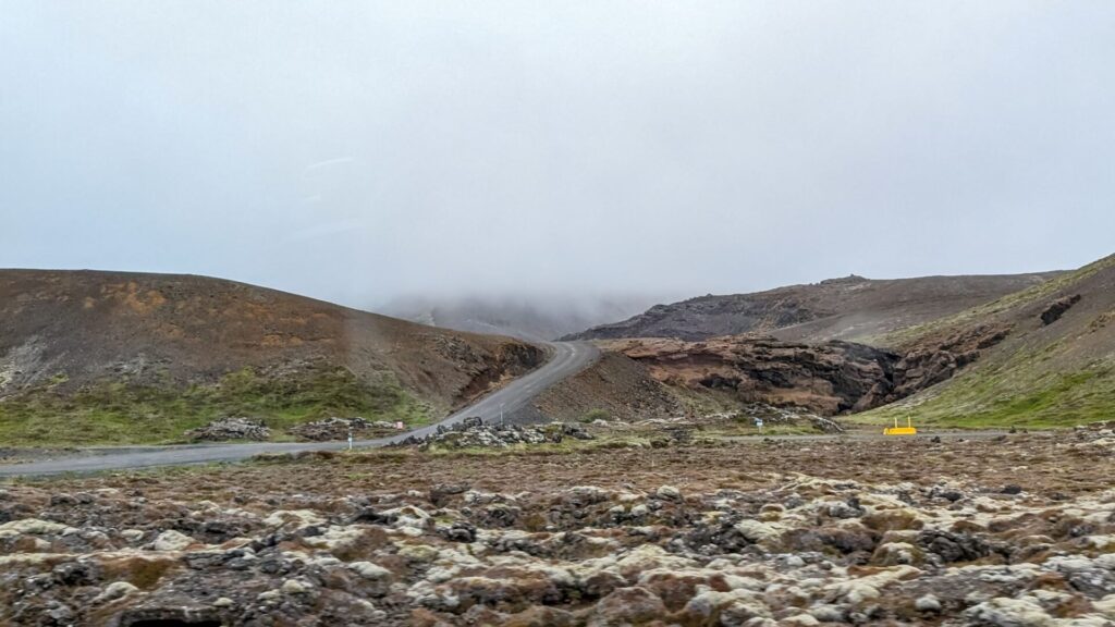
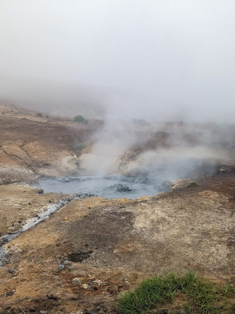
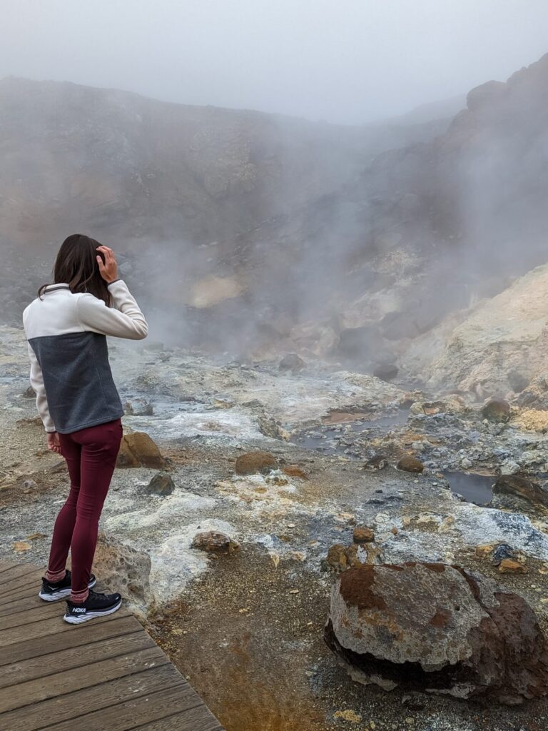
Otherwise, head south out of Reykjavik on Route 40 and back towards the Rekjanes Peninsula. Route 40 will transition into Route 41, and you will eventually meet up with Route 42, where you can turn and continue south to visit the 📍Seltún Geothermal Area. Parking here is free. You can walk around bubbling mud pools and small mud geysers on some wooden paths. Walking the entire area takes about 30 minutes! The area does have a sulfur smell.
Farther south, you can make a stop at the 📍Krísuvíkurberg Cliffs, some coastal cliffs on the south coast of the peninsula. If you climb up the hill, you will get a great view of the cliffs, including a red cliff. This area may be inaccessible currently due to volcanic activity.
Due to road closures, you will likely need to backtrack at this point, so head back up Route 42 and west on Route 41. When you get near the town of Njarðvík, head south to visit the last few stops on the Reykjanes Peninsula.
Along the southwest coast of the peninsula is the 📍Brimketill Lava Rock Pool, a coastal rock pool with an easily accessible viewpoint. Nearby, you will also find the 📍Gunnuhver Hot Springs, 📍Reykjanes Lighthouse, and a couple of scenic coastal viewpoints, all in close proximity to each other. The hot springs are similar to Seltún, so if you don’t want to backtrack twice, this is the most optimal geothermal area of the two to visit!
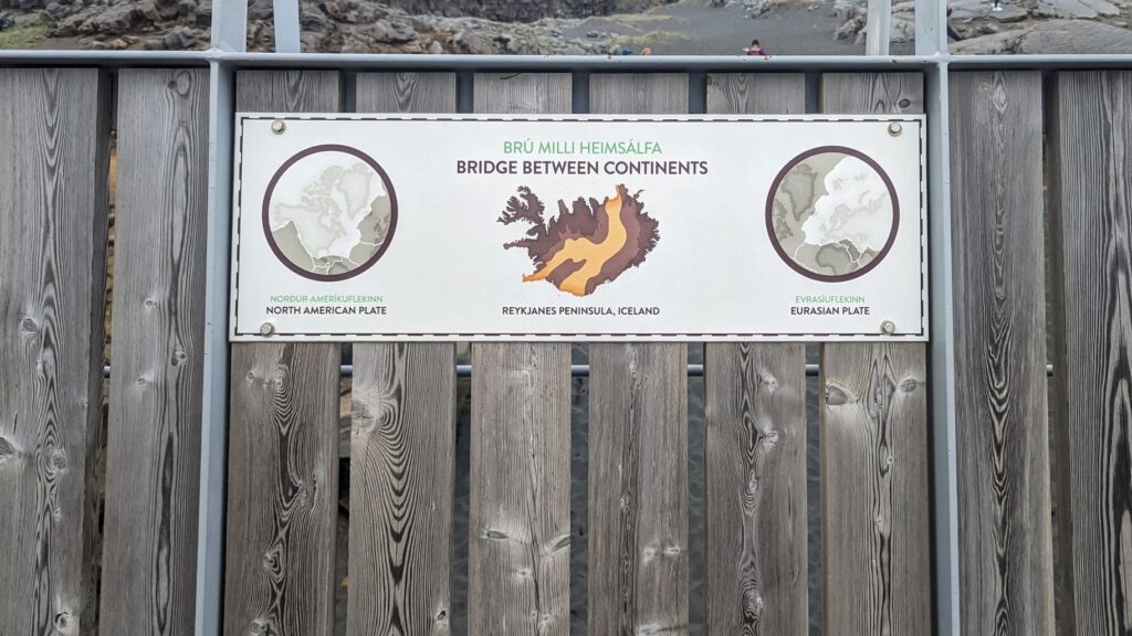
As you drive back north to drop off your car and head to the airport, you can stop at the 📍Bridge Between Continents. While the bridge itself is more symbolic and does not technically span between the North American and Eurasian tectonic plates, it’s still a fun stop and a great place to learn about Iceland’s geology.
Finally, one optional last stop on your Iceland adventure is the 📍Hafnarberg Sea Cliffs; the cliffs require an approximately 1.5 mile (2.41km) hike, and you will get a once final look at the dramatic sea cliffs in the Reykjanes Peninsula.
Make your way back to the airport.
Things to do in the Reykjanes Peninsula:
- Walk the wooden paths at the Seltún Geothermal Area
- Drive past lots of sheep to see the Krísuvíkurberg Cliffs
- Visit Reykjanes Lighthouse, the oldest lighthouse in Iceland
- Check out the bubbling mud pools at Gunnuhver Hot Springs
- Drive past lots of sheep to see the Krísuvíkurberg Cliffs
- Visit Valahnúkamöl, an old lava field with waves crashing against it’s shore
- Walk the Bridge Between Continents
Not Sure What to Pack?
Check out my Iceland Sumer Packing Guide
Itinerary Recap
- Arrival, Blue Lagoon, Reykjavik (Day 1)
- Golden Circle (Day 2)
- South Coast (Day 3 & 4)
- Eastern Fjords (Day 5)
- Northern Iceland (Day 6 & 7)
- Northern Iceland/Snæfellsnes Peninsula (Day 8)
- Snæfellsnes Peninsula/Reykjavik (Day 9)
- Reykjanes Peninsula, Departure (Day 10)