
Arizona hiking trails offer so much variety with the diverse topography around the state, it is a fantastic location for hiking. The greater Phoenix area alone has hundred of easily accessible hikes. Anywhere you visit in Arizona is bound to offer an exciting trail. Grab your boots, sunscreen, and water, and see what the Grand Canyon state offers!
Below is a collection of trails I have personally hiked in Arizona. Included are the map locations and some details about each of these hikes!
(updated periodically with new hikes – most recent update, January 2024)
Superstition Mountains
Phoenix Metro Area
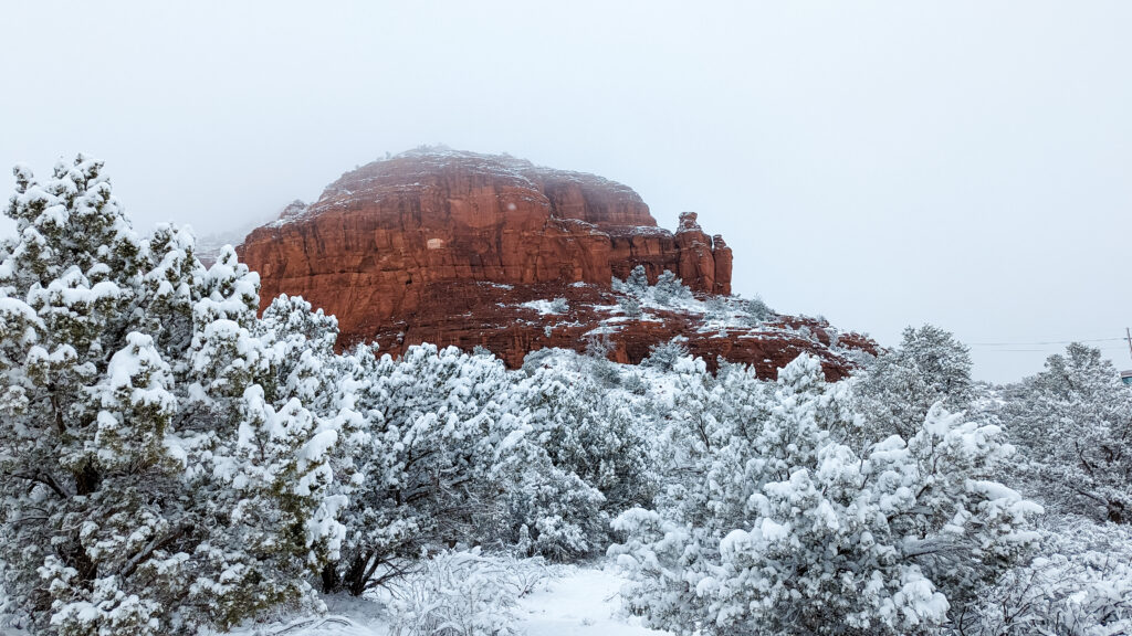
Sedona
Pinetop-Lakeside
Treasure Loop Trail – Apache Junction
Treasure Loop Trail is a moderate hike in Apache Junction within Lost Dutchman State Park and the Superstition Mountain Range. The trail is easily accessible, with ample parking. The park’s entry fee is based on your entry method and day of the week; personal vehicles are $7-10. Lost Dutchman State Park also has bathrooms and picnic areas!
If you are looking for a hike that starts easy and gets more difficult, make sure you go clockwise! Going clockwise, this trail starts easy and flat and slowly becomes steeper as you get closer to the halfway point of the loop, next to the mountains. The trail is never too steep, making this a moderate trail that is for everyone. The halfway point has some great photo locations and a few areas to rest before heading back down. Heading down is steeper watch your footing, so you don’t slip!
Lost Dutchman State Park and this particular trail are popular and busy; expect to be hiking with others and possibly waiting a few minutes for favorite photo areas!
Difficulty: Moderate
Length: 2.3 Miles
Type: Loop
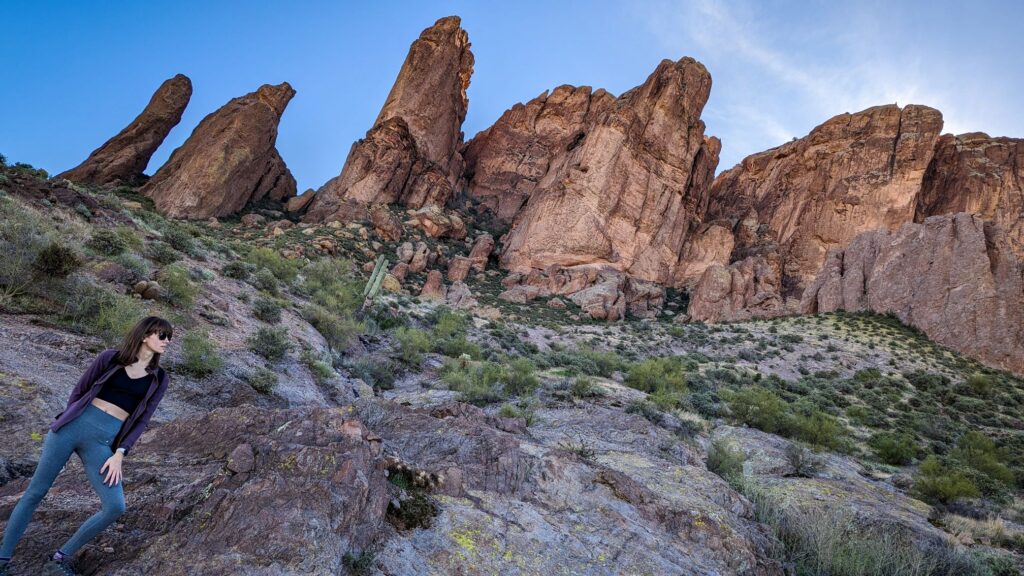
Hieroglyphic Trail – Gold Canyon
Hieroglyphic Trail is a moderate hike in Gold Canyon within the Superstition Mountain Range. The trail can be accessed by driving through a local neighborhood, and there is a large parking lot at the beginning of the trail.
This trail starts easy and flat and slowly becomes more steep and rocky as you get closer to the Petroglyph Spring at the end of the hike. To access the spring and the petroglyphs, you must climb over a few large boulders at the very top. If you are lucky and it has recently been raining, the spring will be full and flowing through the small valley. Watch out for wasps and bees near the spring.
This trail can be popular and busy, but it is possible to have the area to yourself if you visit during the week rather than the weekend.
Fun Fact: Despite being named the Hieroglyphic Trail, the trail actually has petroglyphs. Hieroglyphs are an ancient writing system, while petroglyphs are pictures carved into stone.
Difficulty: Moderate
Length: 3 Miles
Type: Out & Back
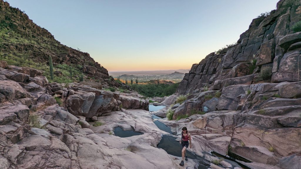
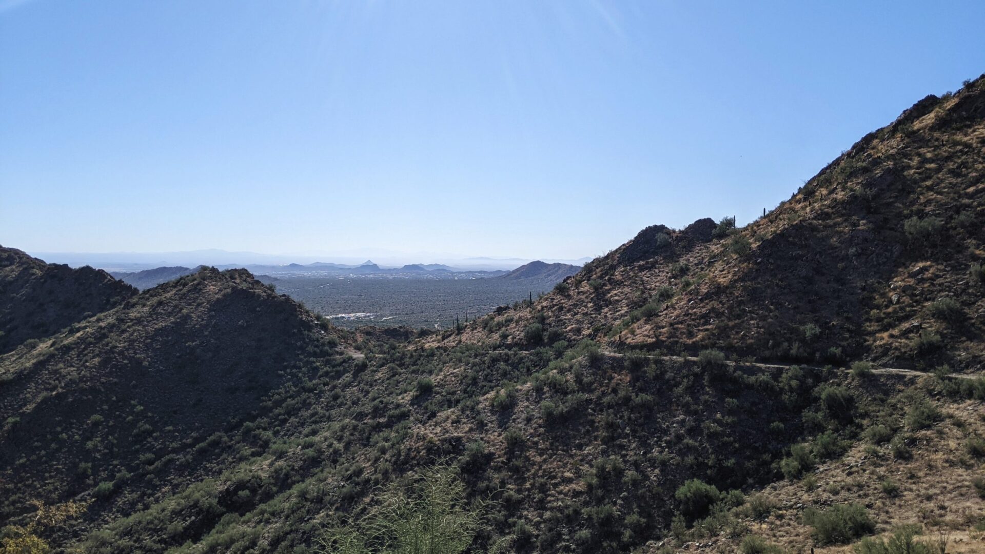
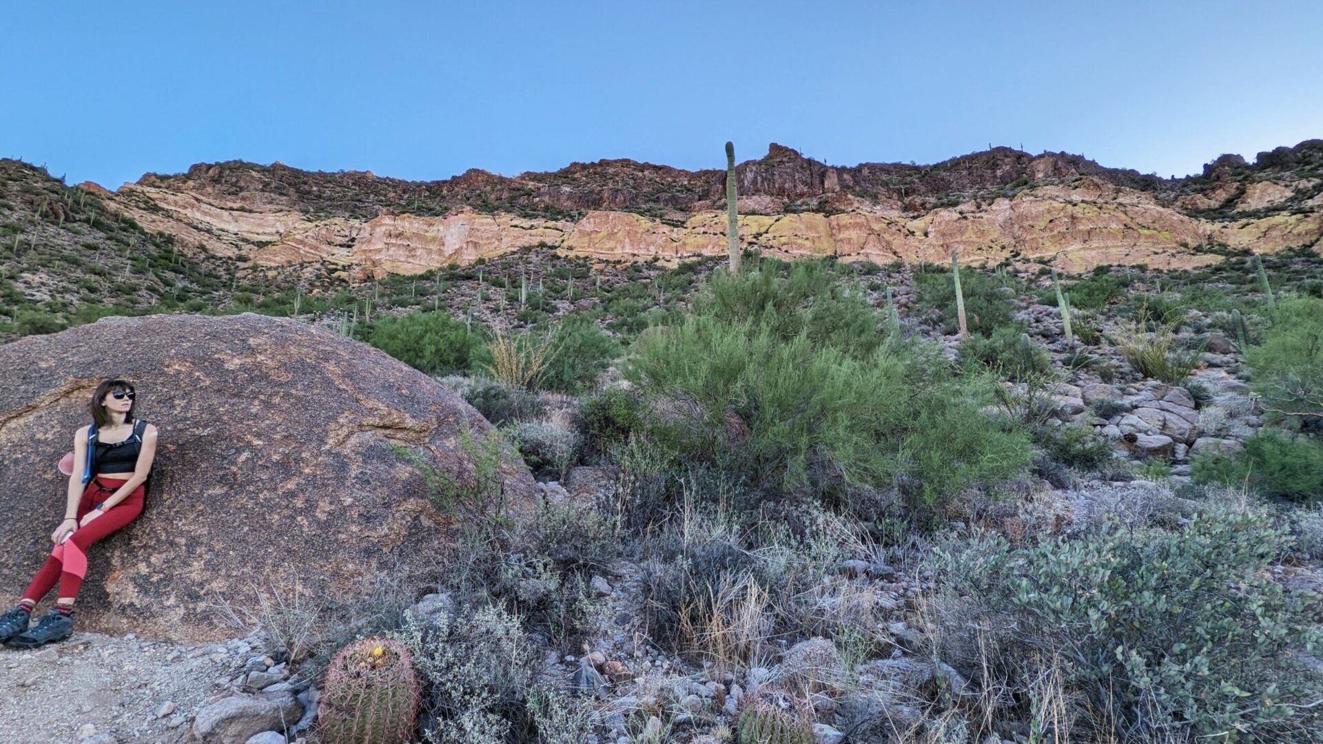
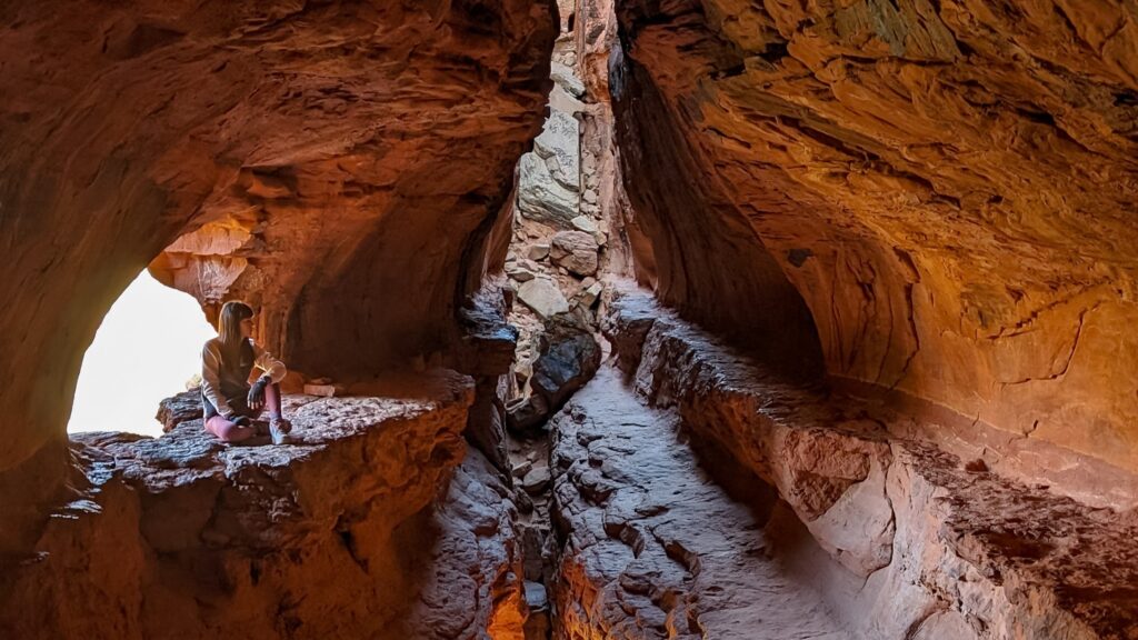
Wave Cave Trail – Gold Canyon
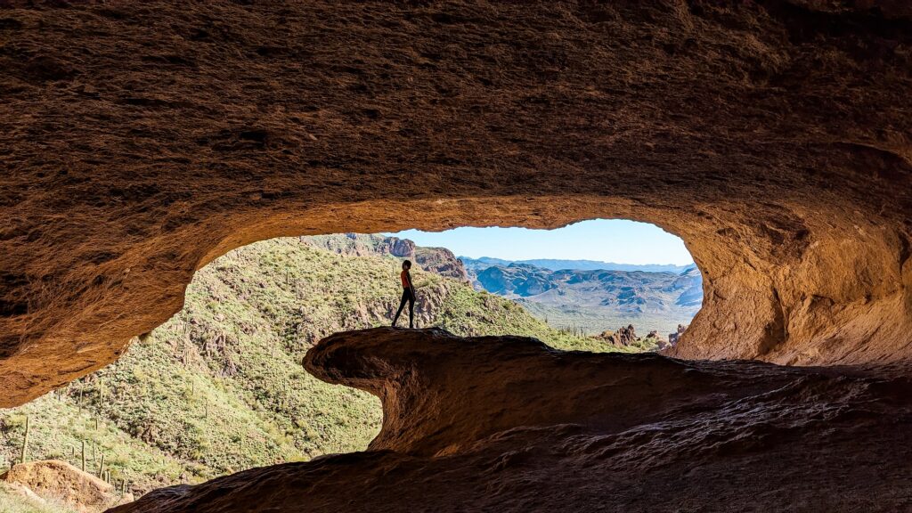
Wave Cave Trail is a hard hike in Gold Canyon within the Superstition Mountain Range. The trail can be accessed by driving down Peralta Road, which does become a dirt road. A vehicle with high clearance would be ideal! the trail starts at the Carney Springs trailhead and requires a walk up the old Carney Springs Road. There are no facilities at the trailhead.
This trail starts easy and flat and quickly becomes gravely and rocky. The final 1/3 mile of the hike is pretty steep and likely will require you to use your hands. There is a total elevation gain of 869 feet. Despite the popularity, this is not an easy hike; we definitely saw people turn back.
However, the cave at the summit is completely worth the trip! The inside of the cave is quite large and is very cool and refreshing. The view is amazing. Be careful on your way down; it’s even more slippery climbing down.
Difficulty: Hard
Length: 3.7 Miles (With Carney Spring Rd)
Type: Out & Back
Hole in the Rock – Phoenix
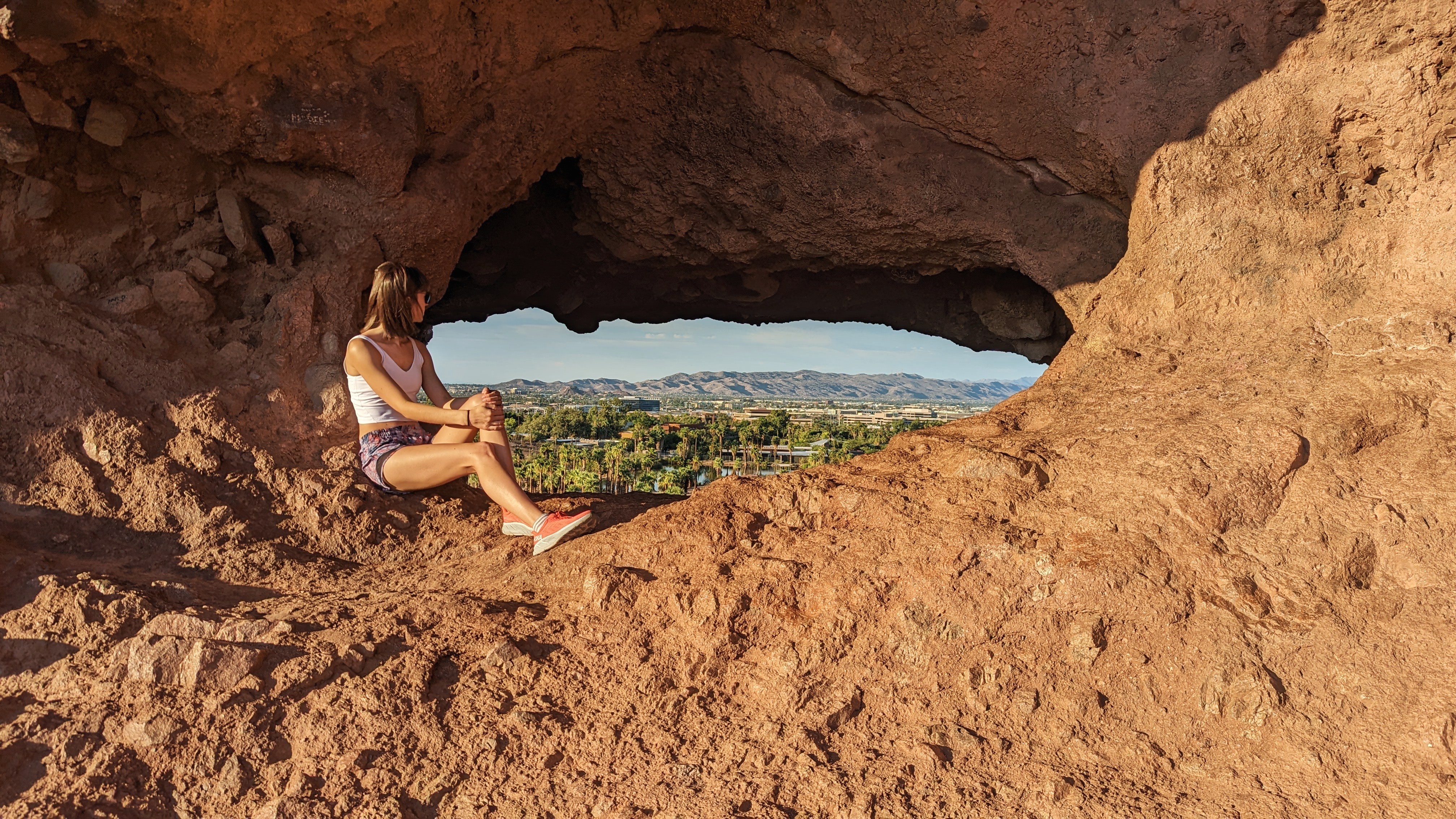
Hiking doesn’t get any easier than Hole in the Rock. The location is easily accessible and close to many popular destinations, such as the Phoenix Zoo and Desert Botanical Garden. With the hike located in Papago Park, there is ample close parking and restrooms.
The hike itself is a quick 5-10 minute walk around the back of the rock ending at the hole. The hole offers a great view of Papago Park and Phoenix. You can also climb through the hold into a shaded cave area that is the perfect place to sit and watch the sunset!
Given the central location and ease of this hike, it is very popular with locals and tourists, so expect it to be busy. You may have to wait to take a photo in the hole. If you are looking for a lighter crowd, skip sunrise and sunset.
Difficulty: Easy
Length: 0.3 Miles
Type: Out & Back
Goldmine Trail – Queen Creek
The Goldmine Trail is the main attraction of San Tan Mountain Regional Park. The location is easily accessible by car and has ample parking. This hike can be tackled from two different starting points in the park. The park’s entry fee is based on your entry method; personal vehicles are $7.
The hike is on the more difficult end of moderate, with a few steep and rocky areas. San Tan Mountain Regional Park is a popular area for locals with many available trails, and this particular hike gets busy. Expect to see dogs, horses, and mountain bikers on the trail.
The entire hike is from one parking lot to another at opposite ends. If you don’t want to make a complete round trip, you can stop at the top of the mountain and work your way back the way you came. Additionally, you can make this trail a loop by adding it to the Dynamite trail.
Difficulty: Moderate
Length: 4.7 Miles
Type: Out & Back
Wind Cave Trail – Mesa
Wind Cave Trail is a moderate hike in Mesa located within Usery Mountain Regional Park. The trail is easily accessible and there are various parking locations within the park, as well as picnic ramadas and restrooms. The park’s entry fee is based on your entry method; personal vehicles are $7.
The hike starts out easy and flat, though there is a bit of loose gravel. As you climb the hike quickly becomes rocky with switchbacks. Don’t be afraid to use your hands to help yourself over and down from the rocky areas. You won’t need to climb on this hike, but watch your step! If you want to continue on to the summit, take a right at the cave and continue up the mountain.
This is a popular trail and can be busy, you will see others during your hike. However, the wind cave itself can often be peaceful and is quite spacious. Be mindful of where you step and sit, you will find bees, snakes, and scorpions on the trail. Don’t hike this one mid-day as you will be in full sun for the duration of the hike. Visit in the morning for a shaded trek.
Difficulty: Moderate
Length: 2.9 Miles
Type: Out & Back
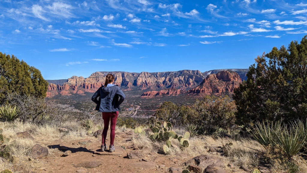
Soldier Pass Trail – Sedona
Soldier Pass Trail is a moderate hike in Sedona. The trailhead has a small parking lot that is only open Monday-Wednesday. On Thursday-Sunday, you should park at the Posse Ground Park and Ride lot and take the shuttle or walk to the trailhead. The shuttle operated approximately every 40 minutes and the walk from the lot to the trailhead is about 1.4 miles.
The trail itself is an out-and-back that intersects with the Brins Mesa Trail. Most people who make this hike end at the Soldier Pass Cave, just east of the main trail. You can find the break-off for the cave at a trail split marked with a wilderness sign. Even if you aren’t interested in the cave, the direction of the cave offers a great flat viewing area!
You can also find Devil’s Kitchen, a sinkhole, and Seven Sacred Pools along this trail. This is a popular trail because it is easy to access and has multiple interesting stops along the way. Expect crowds on this trail, and show up early to avoid the heavy crowds.
If you visit the cave, you will have to scramble to get up into the cave. Be mindful of your footing as you climb into and around the cave!
Difficulty: Moderate
Length: 4.5 Miles
Type: Out & Back
Devil’s Bridge via Mescal Trail – Sedona
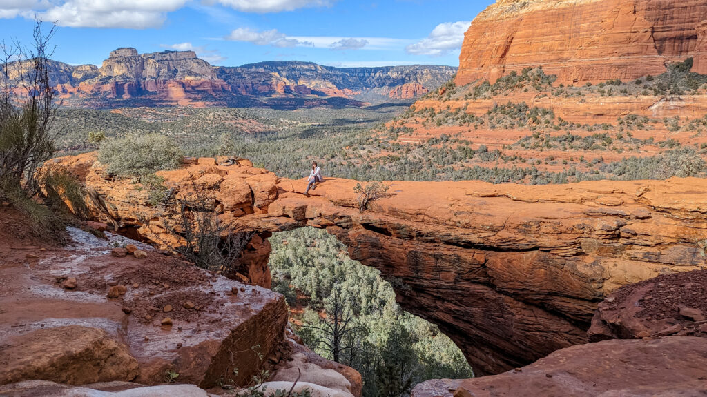
Devil’s Bridge via Mescal Trail is a moderate hike in Sedona. The Devil’s Bridge trail can be reached from multiple starting points. You can either drive or hike in via Dry Creek Road, or you can hike in via Mescal Trail and Chuck Wagon Trail. If you decide to drive in, make sure you have a high-clearance vehicle that can handle a bumpy dirt road.
We chose to hike in via Mescal Trail, which meets up with Chuck Wagon Trail and then Devil’s Bridge Trail. This direction is more visually interesting, and the distance is the same as the Dry Creek Road. The start of Devil’s Bridge Trail is marked clearly once you cross the road.
The hike up to Devil’s Bridge is 1..8 miles roundtrip from the trailhead. The first half of the hike is quite easy and flat. As you make your way up to the mountain, you start to gain elevation and eventually will have to do a small scramble to get up to the bridge area. If you arrive early or get lucky with a quiet day, you won’t find a line for the bridge; however, expect that most days and times will have a wait, sometimes over an hour. This is one of the most popular hikes in Sedona.
We waited 20 minutes to walk onto the bridge when we visited mid-day at the end of February. This typically would be a busy time, but an incoming snowstorm resulted in fewer tourists in the area.
Difficulty: Moderate
Length: 4.0 Miles
Type: Out & Back
Sterling Pass Trail – Sedona
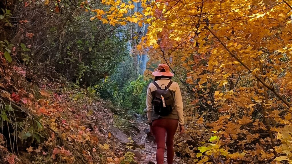
Sterling Pass Trail is a hard hike in Sedona. You can reach the trailhead via State Route 89A, which is the scenic road between Sedona and Flagstaff. There is very little parking for this trail, and the trailhead is directly off of the road, and you must park along the road. This is an easy one to miss, and you will likely have to turn around and head south to be able to pull off. You will also need a Red Rock Pass to park for this trail. You can purchase a one-day pass online for $5.
The trail immediately has some quick elevation gain to get up off the road. You can expect a lot of ups and downs heading in both directions on this trail; it is definitely a good workout! There are also some slippery sections due to dirt and small rocks. The views along the entire hike are incredible, and if you visit during the fall, you can expect to see gorgeous fall colors.
This general area along 89A is considered a busy area for hiking; however, due to the limited space to park for this trail, you likely will see few other people along the trail. We only saw one other person during peak fall foliage.
Difficulty: Hard
Length: 5.1 Miles
Type: Out & Back
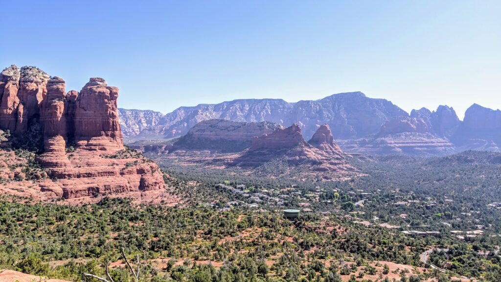
Airport Loop Trail – Sedona
Airport Loop Trail is a moderate hike in Sedona. This trail loops around the Sedona airport on top of the mesa at the center of town. There is a small parking lot near the Airport Mesa Viewpoint at the start of the trail. However, you are most likely to find parking up on the Mesa at the overlook, which costs $3. You will have to hike down the Sedona View Trail to the beginning of the loop. You can also consider adding the Summit Trail to visit the top of the Airport Mesa Vortex.
The loop is quite a scenic hike as you get 360-degree views of Sedona. The hike overall is relatively easy, and there are only a few areas that would be considered moderate. There is little shade along this trail, so make sure you bring a hat and sunscreen. The trail felt much longer than 3.3 miles due to the heat and lack of shade – and we visited in February.
Airport Mesa is a popular area to watch the sunset over Sedona, so if you can time your hike for the early evening, you will also get a great view of the sunset as you finish.
Difficulty: Moderate
Length: 3.3 Miles
Type: Loop
Sugarloaf Summit via Tea Cup Trail – Sedona
Sugarloaf Summit via Tea Cup Trail is a moderate hike in Sedona. Tea Cup Trailhead, which meets up with Sugarloaf Loop/Summit, has a small parking lot for about ten cars. The trailhead is located within a neighborhood. This trail meets up with several other trails, so it can be a good starting point if you are interested in a longer hike.
The hike up to the Sugarloaf Summit has about 300 feet of elevation gain, with most of the gain in the last 0.75 miles. Once you are at the summit, you will have great views of buttes north of Sedona as well as the urban area of Sedona.
This is a great short hike to start the day. You can also continue to Thunder Mountain Trail on your way back or head towards Soldiers Pass Trail.
Difficulty: Moderate
Length: Approximately 1 Mile
Type: Out & Back
Thunder Mountain Trail to Andante Loop – Sedona
Thunder Mountain Trail is a moderate hike in Sedona. This area is quite popular for hiking due to its ease of access. You will also find many mountain bikers along this trail. If you are starting this trail from the Thunder Mountain Trail parking lot, you will have a fair amount of parking.
This trail is beautiful and offers lovely views of Sedona’s buttes and urban areas. The hike is relatively easy and has many flat areas. The Thunder Mountain Trail along the butte is fun and really pretty. You will be closer to the houses bordering the mountain along the Andante trail. There are multiple places where you can cut between the two trails.
Consider stopping at the Peace Park either on your way out or back; it is a nice little area to break up the hike. There is also parking at the Peace Park if you cannot find parking at the trailhead.
Difficulty: Moderate
Length: 3.0 Miles
Type: Loop
Fun Fact: We did find that the start of Thunder Mountain Trail was a great place to visit after a large snow storm. There is a bunch of parking, and it’s easy to access even with snow.
Mogollon Rim Trail – Pinetop
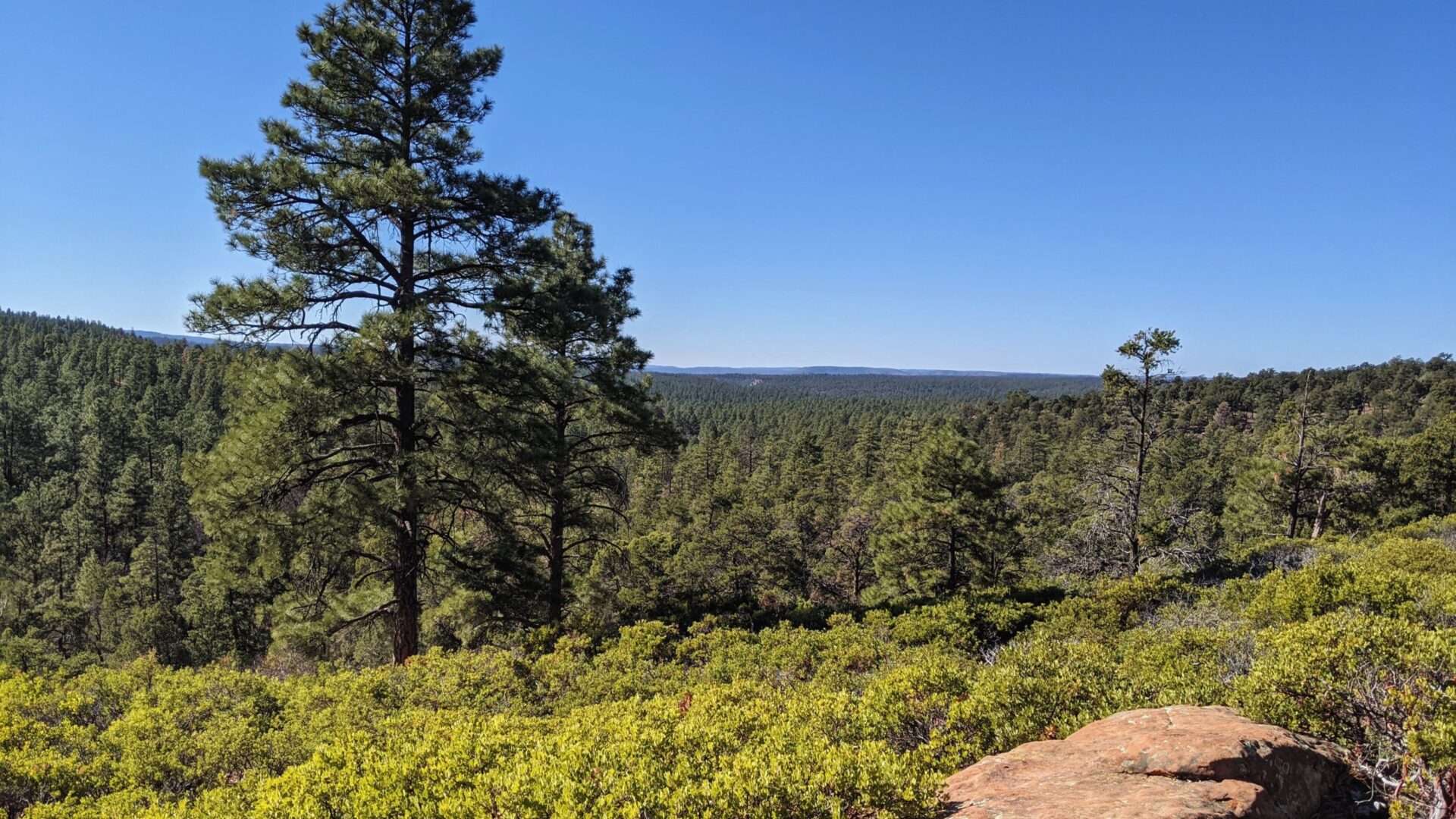
The Mogollon Rim Trail is an easy, paved trail with a beautiful view of the hundreds of ponderosa trees on the rim. It’s the perfect place to visit after a light dusting of snow. There is a small parking lot at the entrance to the trail.
You can find signs detailing the area’s history along this short trail. Expect to see other people on this trail as it is a popular area for a walk in Pinetop. This is a perfect area to bring the kids.
The Mogollon Rim Trail was once a loop owned by the Federal Forest Service but was sold to a private owner in recent years. The trail was converted to an out and back after this sale. Make sure you respect the private property and stay on the path to ensure this hike remains open to the public!
Difficulty: Easy
Length: 0.8 Miles
Type: Out & Back


